

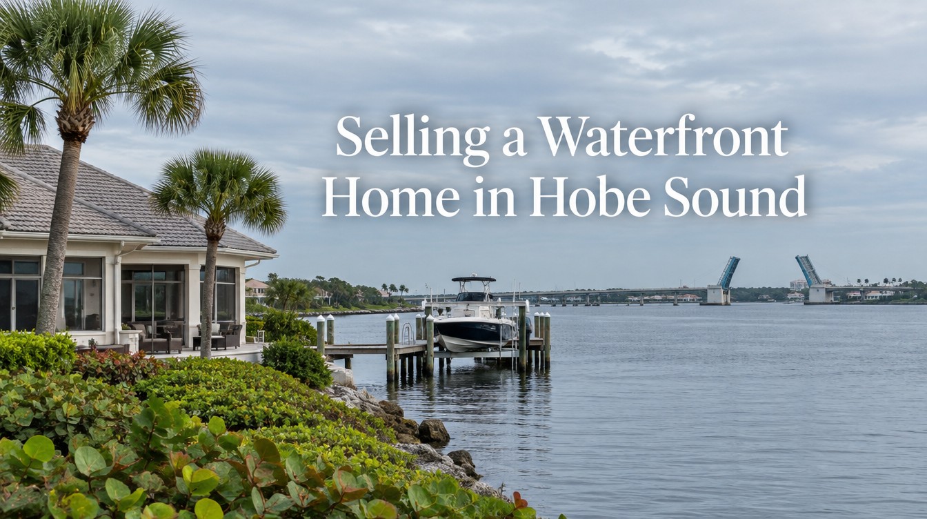
Selling a Waterfront Home in Hobe Sound
The largest sales with a Hobe Sound address in 2025 were on South Beach Road, across the CR 708 bridge on Jupiter Island. A mainland Hobe Sound waterfront home is priced from different evidence: its own comparable sales, the bridge between the dock and the inlets, the Martin County shoreline protection zone and the county flood map. This guide shows where each piece of that evidence comes from and in what order to gather it.
Seller Answer in Brief
Price a mainland Hobe Sound waterfront home from mainland sales only. The Town of Jupiter Island shares the 33455 Hobe Sound mailing address, so public lists of “Hobe Sound” sales mix in Jupiter Island estates that sell under different rules and land values. Build the comparable set from Martin County parcel records, adjust for water depth, the CR 708 bridge and the shoreline protection zone, and have the flood, dock and permit records ready before the home goes live.
- The Town of Jupiter Island lists its Town Hall at 2 Bridge Road, Hobe Sound, FL 33455 (Town of Jupiter Island website, accessed October 2026).
- Redfin data republished by Stacker (September 2025) labels three South Beach Road sales of $23.35 million to $31.95 million as “Hobe Sound.” Those are barrier island estates, not mainland comparables.
- The CR 708 Hobe Sound bridge is a bascule span at Intracoastal Waterway mile 995.9 with 21 feet of closed vertical clearance and 90 feet horizontal, opening on request (Waterway Guide).
- Martin County sets a shoreline protection zone on every lot on navigable estuarine water: 25 feet on many older lots of an acre or less, 75 feet on lots over two acres (Martin County Environmental Division).
- Martin County’s flood maps took effect February 19, 2020, and the county holds a Community Rating System Class 5 (Martin County Flood Zones page).
- Martin County commissioners voted in March 2025 against quiet zones at the county’s 27 rail crossings, so train horns continue on the FEC line through Hobe Sound (WPTV and WFLX reporting).
In this guide
- Why a Hobe Sound address does not tell you which market you are in
- Building a comparable set for mainland Hobe Sound waterfront
- The numbers a Hobe Sound pricing review has to measure
- The CR 708 bridge and the route to the inlets
- The Martin County shoreline protection zone
- Dock, lift and seawall records in Martin County
- Flood zone, elevation certificate and the disclosure form
- Rail crossings, sewer service and redevelopment zoning
- A preparation sequence for a Hobe Sound waterfront listing
- Closing costs and recording in Martin County
- Frequently asked questions
Why a Hobe Sound address does not tell you which market you are in
Two very different places share one name and one ZIP code. Hobe Sound, the mainland community along US 1 and Dixie Highway, is unincorporated Martin County. It has no town government of its own; the Martin County Board of County Commissioners and the county Growth Management Department set its land use rules. Across the water sits the Town of Jupiter Island, a separate municipality with its own commission, its own building department and its own code. Its Town Hall is at 2 Bridge Road, and its mailing address reads Hobe Sound, FL 33455 (Town of Jupiter Island).
That shared address shows up in every data feed that sorts sales by city name. In September 2025 Stacker republished a Redfin list of the most expensive homes sold so far that year in the Port St. Lucie metro area, using data current to August 5, 2025. The top two were labeled Jupiter Island: 320 S Beach Rd at $39,000,000 and 310 S Beach Rd at $33,843,820. The next three were on the same road and labeled Hobe Sound: 433 S Beach Rd at $31,954,500, 402 S Beach Rd at $24,290,425 and 318 S Beach Rd at $23,350,000 (Stacker, Redfin data, September 2025). South Beach Road runs along Jupiter Island. The label changed; the island did not.
For a mainland owner, this matters in a specific way. A buyer, an appraiser or a neighbor who searches “Hobe Sound sold” on a consumer portal will see eight figure prices. Some sellers then assume their own water frontage on the mainland side of the sound belongs in the same conversation. It does not, and the difference is not only the size of the houses. The island parcels are governed by a different municipality, front the Atlantic or both the ocean and the sound, and sit behind the town’s own development rules. The mainland parcels are governed by Martin County, front the Intracoastal Waterway or the lagoon, and are reached by a public road network that the island does not share.
There is a second version of the same mistake. Some aggregators treat everything in 33455 as one market, which also pulls in inland subdivisions, golf communities and acreage west of US 1. A median for “Hobe Sound” from that kind of source blends homes with no water at all into the figure. It is too low to describe a waterfront home and too high to describe the inland stock, which is why it is useless for pricing either one.
The fix is mechanical. Every sale considered as a comparable should be checked against its Martin County parcel record, which shows the taxing district and the legal description. If the taxing district is the Town of Jupiter Island, the sale belongs to a different study. The site already has a guide to that market, selling on Jupiter Island without comparable sales, and the methods there do not transfer across the bridge.
Building a comparable set for mainland Hobe Sound waterfront
Mainland Hobe Sound waterfront is a small pool, so the comparable set has to be defined before anyone looks at prices. Otherwise the set grows to include whatever sold recently, and the price follows the set.
Start with geography. The mainland frontage that matters here faces the water body that gives the community its name: the stretch of the Intracoastal Waterway called Hobe Sound, between the mainland and Jupiter Island, which is part of the Indian River Lagoon system. North of the CR 708 bridge the channel narrows; Waterway Guide places the bridge just south of South Jupiter Narrows (Waterway Guide, Hobe Sound CR 708 Bridge). A home on open sound frontage, a home on a canal off the sound and a home on the narrows each sell to a slightly different boat and a slightly different view, and the comparable set should keep them apart or adjust for them openly.
Then decide how far the search can reach when mainland sales run thin. The honest order is to widen time before widening place: 24 months of mainland Hobe Sound waterfront sales first, then 36, and only after that the nearest Martin County mainland waterfront with similar water, such as the Intracoastal frontage farther north toward Port Salerno or the river frontage covered in the site’s guide to selling a waterfront home in Stuart or Palm City. Northern Palm Beach County waterfront, a few miles south, sits under a different county, a different flood map and a different code, so it is a reference point at most.
| Comp set rule | How to apply it | Why it changes the price |
|---|---|---|
| Exclude Town of Jupiter Island parcels | Check the taxing district on each Martin County Property Appraiser record | Removes barrier island sales that share the 33455 address |
| Exclude non waterfront 33455 sales | Confirm frontage on the parcel map and the survey, not the listing remarks | Stops inland and golf course sales from pulling the figure down |
| Separate frontage types | Open sound, canal, narrows north of the bridge, lagoon with mangrove fringe | Boat size, view width and dock length differ by frontage |
| Record bridge position | North or south of the CR 708 bridge | Sets which inlet trip requires a bridge opening |
| Record dock and lift status | Permitted dock, lift capacity, water depth at the end of the dock | A permitted dock that fits the buyer’s boat is priced, a missing one is a project |
| Record the shoreline protection zone width | 25 feet or 75 feet, from the plat date and lot size | Controls how much of the lot a buyer can build on near the water |
| Record flood zone and finished floor elevation | From the county FEMA map and the elevation certificate | Feeds the buyer’s insurance quote, which feeds the offer |
The table is a working tool, and every row can be checked from a public record. None of it requires a club document or a private file, which is one advantage the mainland has over the island.
Land value deserves its own line. Many mainland waterfront sales near the top of the local market are bought for the lot and the dock, with the house treated as a renovation project or a teardown. In that case the comparable that matters is a recent sale of a similar frontage, regardless of the house on it, and the existing home is priced as a credit or a cost against that land figure. Sellers who expect their kitchen remodel to carry the price should know which kind of buyer the comparable sales point to before they spend money on preparation.
One practical point on timing: Martin County Property Appraiser sales records lag behind the closing date by the recording interval at the Clerk, so the most recent sale in the neighborhood may not show on the parcel record yet. An authorized MLS export fills that gap. Public records then confirm what the MLS shows, including the recorded price and any non arm’s length transfer that should be dropped.
The numbers a Hobe Sound pricing review has to measure
Public records can measure part of this market, and they show why the comparable set has to be cleaned before it is used. On October 8, 2026 the Martin County Property Appraiser sales search was queried for recorded sales from October 1, 2024 through September 30, 2026 at a recorded price of $1,000,000 or more in property use class 0100 (single family). The results were split by the taxing municipality on each parcel record, and each deed book and page was counted once (Martin County Property Appraiser, Sales Search).
| Recorded single family sales, $1,000,000 and up, Oct. 2024 to Sep. 2026 | Mainland Hobe Sound (unincorporated Martin County) | Town of Jupiter Island |
|---|---|---|
| Recorded sales | 104 | 50 |
| Median recorded price | $1,730,500 | $9,887,500 |
| Highest recorded price | $6,100,000 | $58,000,000 |
| Sales of $3,000,000 or more | 24 | 49 |
| Sales recorded February through June | 62 of 104 | 32 of 50 |
Two limits apply. The Martin County sales search does not display a qualified or unqualified flag, so a few of these transfers may not be arm’s length, and each one used as a comparable still has to be opened and checked. The property use class also does not say whether a parcel is on the water. Most of the mainland sales near the top of the list are in golf communities such as Loblolly Pines, the Medalist Club and the Hobe Sound Golf Club, not on the sound. A waterfront comparable set is built from this list by opening each parcel, confirming the frontage on the county map and dropping the rest. What the table does show is the size of the Jupiter Island problem: one median is more than five times the other, so a single “Hobe Sound” figure that blends the two describes neither market.
The figures that decide timing and the opening price are not in any public record: list prices, days to contract, the ratio of sale price to original list price, price reductions, expired listings and the active listings on the launch date. They come from an MLS search run by a licensed agent for mainland waterfront parcels in 33455, with Town of Jupiter Island parcels removed. Ask for each one with its sample size. Days to contract sets the date for the first price review after launch. The sale to original list ratio shows how far recent sellers had to move from their opening number. The active listings on the launch date are the homes a buyer will tour the same weekend, and they matter more than last year’s closings. If the waterfront set holds fewer than 10 sales over 24 months, extend the period to 36 months before widening the area, and say so in writing.
A few rules keep the table honest. Each figure carries its sample size. Sales with a seller credit or a leaseback are flagged, because the recorded price overstates what the seller kept. Sales between related parties come out. And when the set is small, the review says so in plain words instead of reporting a median of four sales as if it were a trend.
The last row of the table is worth a note. Many sellers in Martin County list in winter on the assumption that seasonal residents drive the top of the market. In the recorded data, 62 of the 104 mainland sales of $1,000,000 or more were recorded from February through June, which supports a listing that is live and fully documented by late winter. A recording date trails the contract date by the length of the escrow, so the contract month sits earlier than the table shows, and the waterfront subset may be too small to read on its own. If it is, the decision turns on the competing inventory on the launch date and on how ready the documents are, which the seller controls.
The written pricing analysis that Jeannie Jacobson prepares for sellers follows this structure: the comparable set and the exclusions, the adjustments, the measured table and the recommended range, all in writing so the owner can test every line.
The CR 708 bridge and the route to the inlets
Every mainland dock on Hobe Sound sits on one side or the other of a single drawbridge, and a buyer with a boat will ask which side before asking anything about the kitchen.
The CR 708 bridge carries SE Bridge Road from the mainland to Jupiter Island. Waterway Guide lists it as a bascule bridge at Intracoastal Waterway mile 995.9 with 21 feet of closed vertical clearance and 90 feet of horizontal clearance in the center span, opening on request; boaters hail the tender on VHF channel 9 or sound one long and one short blast (Waterway Guide). NOAA’s U.S. Coast Pilot 4 confirms the position and the height: it lists the route 708 highway bridge, locally known as the Hobe Sound bridge, at mile 995.9 with a bascule span and a clearance of 21 feet (NOAA, U.S. Coast Pilot 4, chapter 12). The Coast Pilot calls it State Route 708; Waterway Guide and the bridge inventory call it CR 708. Either way, it is the 708 bridge on Bridge Road, not the 707 bridge farther south. National Bridge Inventory data republished by BridgeCondition records a steel two lane movable span built in 1985, about 0.9 miles east of US 1 (BridgeCondition, NBI record FL 890107).
Twenty one feet is the number that sorts buyers. A center console or a bowrider passes under the closed span. A sportfish with a tower, most sailboats and many flybridge yachts do not, which means every trip to the inlet on the far side of the bridge involves a request and a wait. Because the bridge opens on request, the wait is usually short, but schedules can change for repairs; a 2020 boater report on Waterway Guide described a period when only one span opened on a limited schedule. Buyers who run offshore every weekend will weigh that, and the listing should answer the question in advance.
The inlets sit at both ends. To the south, Waterway Guide navigation alerts place the Jupiter Inlet at ICW mile 1004.4, about eight and a half waterway miles below the Hobe Sound bridge, with additional drawbridges in the Jupiter area on restricted schedules and an inlet that marina guides describe as prone to shoaling (Marinas.com, Jupiter Inlet). That second bridge is a different structure with a different number: NOAA’s U.S. Coast Pilot 4 places the State Route 707 bascule bridge at mile 1004.1, near the southern end of Jupiter Sound, with a closed clearance of 25 feet (NOAA, U.S. Coast Pilot 4, chapter 12). Neither the 707 bridge nor the Hobe Sound bridge has a special schedule in the Coast Guard’s drawbridge rules for this stretch of the waterway, which list timed openings for bridges such as Indiantown Road at mile 1006.2 (33 CFR 117.261); a boater should still check the Coast Guard Local Notice to Mariners for repair closures before a trip. To the north the route runs through the narrows toward the St. Lucie Inlet. A home north of the CR 708 bridge reaches the Jupiter Inlet only through it; a home south of it reaches the St. Lucie Inlet only through it.
| Water access fact | Where the seller gets it | What the buyer does with it |
|---|---|---|
| Position relative to the CR 708 bridge | Parcel map | Decides which inlet trip needs an opening |
| Bridge clearance, closed: 21 feet | Waterway Guide bridge record | Compares with the air draft of the boat |
| Depth at the end of the dock at mean low water | Marine contractor sounding or a recent survey with soundings | Compares with the draft of the boat |
| Depth of the route from the dock to the channel | Sounding along the route, NOAA chart | Tests whether the dock depth is usable |
| Lift capacity and age | Manufacturer plate, permit file | Checks the lift against the boat’s weight |
| Dock permit or DEP exemption | Martin County permit file, DEP Southeast District | Confirms the structure can stay and be repaired |
Sellers rarely have the depth figures in writing. A marine contractor can take soundings at the dock and along the route at low tide in a morning, and the result often settles the most common question a boating buyer asks before a showing is booked. A listing that says “deep water” without a number invites the buyer’s own captain to find the number, usually during the inspection period, and usually on a day when the seller has the least room to answer.
Boating access is also covered across the county line in the site’s guide to Jupiter waterfront homes and boating access, which deals with the Jupiter side of the same inlet.
The Martin County shoreline protection zone
The buyer of a mainland Hobe Sound waterfront lot is often buying the right to build, and Martin County limits how close to the water that building can go. The tool is the shoreline protection zone, and its width depends on when the lot was created and how large it is.
The county’s Environmental Division states that all waterfront lots on navigable estuarine waters, canals included, have a shoreline protection zone. For lots of one acre or less that were platted or existed before April 1982, the zone is 25 feet from the shoreline or wetland boundary. For waterfront lots over two acres, it is 75 feet from the mean high water line or wetland boundary, and the 75 foot width also applies to lots of any size created after 1982 by a lot split or other means outside an approved subdivision. Residential lots of one to two acres created before April 1982 can seek a waiver of the 75 foot distance based on site conditions, but never below 25 feet (Martin County Environmental Division FAQs).
Setbacks then run from the edge of the zone. According to the same county page, primary structures are built 10 feet from the shoreline protection zone, wetland buffer or preserve area boundary, and secondary structures such as pools and decks 5 feet from it. Residential owners can build an accessway up to 12 feet wide through the zone. Where mangroves or other wetlands line the shore, they should be avoided, and where they cannot be, one access no wider than 6 feet through them is allowed.
Here is why a seller should know the width before setting the price. Consider two mainland lots of the same size side by side, one platted in the 1970s at under an acre and one created by a lot split in the 1990s. On the first, the buildable area starts 35 feet from the water for the house. On the second it starts 85 feet back. A buyer who plans to tear down and rebuild closer to the view can do it on one lot and not the other, and the price of the land should reflect that. The comparable sales will not show it unless someone records the zone width for each one, which is the purpose of that row in the comp set table above.
The source for the answer on a given lot is the plat and the parcel history. The county’s Preserve Area Management Plan page adds that wetlands in Martin County are protected and that a 50 foot buffer, or 75 feet where the wetland connects to waters of the state, is required around them (Martin County Preserve Area Management Plan). If a lot has a recorded preserve area, the preserve area management plan is a document the buyer’s attorney will ask for. Sellers should find it before the buyer does.
Two exceptions are worth stating. The county summaries are not the code text itself, and setbacks and waiver rules can be amended, so the final answer for a specific lot comes from the Environmental Division at env@martin.fl.us or the Growth Management Department. And existing structures inside the zone that were lawfully built are a different question from new construction; a buyer’s architect will want to know which category each structure falls into.
Dock, lift and seawall records in Martin County
A dock is the first structure a waterfront buyer inspects and the first permit file the buyer’s attorney requests. In unincorporated Martin County the file lives with the Martin County Building Department at 900 SE Ruhnke Street in Stuart, and the paperwork that created it follows a published checklist.
The county’s Dock and Boatlift Checklist, revised February 2026, lists what a dock or lift permit requires: a building permit application, manufacturer specifications for the lift, sealed plans, a survey or signed and sealed site plan with NAVD elevations, flood zone and setbacks, electrical schematics and load calculations, and approval from the Florida Department of Environmental Protection. On that last point the checklist is direct: DEP must issue either a permit or an exemption from permit for any construction on the water, and the county bases its own approval on it. The checklist directs owners to the DEP Southeast District office at 3301 Gun Club Road in West Palm Beach (Martin County Building Department, Dock and Boatlift Checklist).
That two agency structure explains most of the dock questions that surface during a sale. A dock built decades ago may have a county permit and no DEP record in the file. A lift added later may have been installed without a separate permit. A seawall cap replaced after a storm may have been treated as repair. None of these is automatically a problem, but each one is a question, and questions asked during the inspection period cost the seller leverage.
Pull the permit history
Martin County uses Accela Citizen Access for permit searches; a search by address shows the permits on record and their status. Open or expired permits show here first.
Request the files
The county’s building records page takes requests for blueprints, site plans, surveys and permit files through its “Request for Help or Information” form. Emailed copies are free, and a disk costs $1 (Martin County, Request Blue Prints).
Match the file to the structure
Compare the permitted dock dimensions and lift capacity with what is on the water today. Differences are easier to explain, or to close with an after the fact permit, before a buyer’s inspector measures them.
Find the DEP authorization
Ask DEP Southeast District for any permit or exemption letter tied to the parcel. If none exists for an older structure, ask a marine contractor or attorney what the buyer’s lender and insurer are likely to require.
Close what can be closed
An open permit for finished work is often a matter of a final inspection. Scheduling it before listing removes an item from the buyer’s title and lender checklist.
Seawalls deserve a separate inspection. A seawall in the mainland Hobe Sound stretch faces wakes from Intracoastal traffic as well as tides, and the buyer’s insurer may ask about its condition. A written report from a marine contractor, with photographs of the cap, the panels and any weep holes, gives the buyer something to price instead of a guess. The site’s regional guide to waterfront luxury homes covers seawall and submerged land questions in general terms; this section covers only the Martin County paperwork.
Flood zone, elevation certificate and the disclosure form
Flood insurance is the cost a waterfront buyer can measure most precisely before making an offer, and in Martin County the seller can supply most of what the buyer’s agent needs to get the quote.
The county’s flood maps took effect on February 19, 2020, when FEMA combined its coastal risk study with the existing maps. Owners can look up a flood zone by address or parcel ID on the county’s FEMA flood zones map. Martin County holds most elevation certificates on record for homes built after 1991 in Special Flood Hazard Areas, and they can be downloaded from the same map or requested if missing. The county is rated Class 5 in the Community Rating System, which the county says gives a 25 percent premium reduction in Special Flood Hazard Areas and 10 percent elsewhere. Questions go to the Floodplain Coordinator at (772) 288-5466 (Martin County Flood Zones).
For a seller, three things follow. First, download the elevation certificate now. If the home was built before 1991 and the county has none on file, a surveyor can prepare one, and having it in the listing file lets the buyer’s insurance agent quote on day one instead of day ten. Second, know the zone of the lot and of the house; on a sloping waterfront lot they can differ, and the structure’s zone is what the insurer prices. Third, look at the finished floor elevation against the base flood elevation on the certificate, because that number is often the difference between an ordinary premium and one that changes the buyer’s math.
State law adds a disclosure step that applies to every residential sale, including one in Hobe Sound. Section 689.302, Florida Statutes, requires the seller to give the buyer a written flood disclosure at or before the time the contract is signed. In the current text the seller states whether, during the seller’s ownership, the seller knows of flooding that damaged the property, filed a flood insurance claim, including with the National Flood Insurance Program, or received federal flood damage assistance, including from FEMA (Section 689.302, Florida Statutes). The statute defines flooding broadly enough to include tidal overflow and sustained standing water from rainfall.
On the mainland side of Hobe Sound, the honest answers to those questions often depend on storm history the current owner may not remember precisely. Pull insurance claim records before filling out the form. If there was a claim, the repair invoices and any permits for the repair belong in the listing file next to the disclosure, so the buyer reads the explanation together with the answer.
The site’s existing statewide flood disclosure guide covers the form itself in more detail; what changes in Hobe Sound is where the supporting records come from: the Martin County flood map, the county’s elevation certificate archive and the county Floodplain Coordinator.
Rail crossings, sewer service and redevelopment zoning
Some of the questions a buyer asks about a mainland Hobe Sound home have nothing to do with the water. They come from the community’s position between US 1 and the Florida East Coast Railway line, and the seller who can answer them with documents keeps the conversation on price.
Train horns on the FEC line
The FEC line runs through mainland Hobe Sound and carries freight and Brightline passenger trains. In March 2025, after a year of study, Martin County commissioners voted unanimously against establishing quiet zones at the county’s 27 rail crossings, citing safety concerns and the cost of the recommended crossing upgrades; the county’s assistant engineer said trains will continue to sound their horns under federal rules (WFLX, March 2025; WPTV). Waterfront homes east of US 1 sit farther from the tracks than the downtown blocks, but buyers who tour on a quiet afternoon may hear a horn at the second showing. The practical step is to measure the distance from the house to the nearest crossing on the parcel map and have it ready, so the answer is a number instead of a reassurance.
Septic or central sewer
Waterfront buyers along the Indian River Lagoon increasingly ask whether a home is on septic, because Martin County has run a septic to sewer conversion program since 2015 with a stated aim of removing about 10,000 septic tanks countywide over 10 years. The county’s 2025 project in New Monrovia and Port Salerno received a $12.5 million state grant, and the utilities director estimated connection costs below $12,000 per home (WFLX, March 2025). Reporting found no schedule specific to Hobe Sound. A seller should confirm with Martin County Utilities whether the parcel is on central sewer, whether a future project includes it and whether any assessment has been levied. If the home is on septic, a recent pump out and inspection report answers the buyer’s first question.
The Hobe Sound Community Redevelopment Area
Martin County adopted the Hobe Sound Community Redevelopment Plan in 2000. The Hobe Sound Neighborhood Advisory Committee advises the county’s Community Redevelopment Agency and meets at the Hobe Sound Community Center on Olympus Street. Development inside the area follows the Hobe Sound Community Redevelopment Code, Article 12, Division 1 (Uniform Redevelopment Standards) and Division 5 (Hobe Sound), with Bridge Road as the focus of the vision plan (Martin County, Hobe Sound CRA). Most waterfront estates sit outside it, but parcels near Bridge Road and US 1 should be checked, because a buyer looking at redevelopment potential will read the zoning before the listing.
Conservation land across the water
Large parts of the shoreline around mainland Hobe Sound are public conservation land. The Nathaniel P. Reed Hobe Sound National Wildlife Refuge, established in 1969, is divided by the lagoon into a Jupiter Island tract of 735 acres and a mainland tract of sand pine scrub, about 1,091 acres in total (Recreation.gov, Hobe Sound NWR). Jonathan Dickinson State Park, at 16450 SE Federal Highway, covers about 11,500 acres and contains the Northwest Fork of the Loxahatchee River, designated a National Wild and Scenic River in 1985 (Florida State Parks, Jonathan Dickinson guide). For a waterfront seller the relevance is physical: a home whose view looks across to refuge land faces a shoreline that is not going to be developed, and that fact belongs in the listing with a map, not an adjective. Owners on the river side of the park should read the series guide to selling a home on the Loxahatchee River.
A preparation sequence for a Hobe Sound waterfront listing
The order matters more than the list. Documents that change the price come first, cosmetic work comes last, and nothing goes live until the questions a buyer’s captain, insurer and attorney will ask have written answers in the file.
Confirm the jurisdiction and the parcel facts
Print the Martin County Property Appraiser record. Confirm the taxing district is unincorporated Martin County, note the legal description, the plat and the year the lot was created, and the recorded exemptions. This sets the comparable set and the shoreline protection zone width.
Order a current survey
A boundary survey showing the mean high water line, the shoreline protection zone, the flood zone and the dock lets the buyer’s lender and title company work from the seller’s document. The county’s dock checklist already asks for NAVD elevations and flood zones on site plans, so a surveyor familiar with Martin County submittals knows what to show.
Download or order the elevation certificate
From the county FEMA flood zones map for homes built after 1991, or from a surveyor for older homes.
Pull permits and close open ones
Accela search, records request for the files, final inspections scheduled for any open permit tied to finished work.
Document the water
Soundings at the dock and along the route at low water, lift capacity, dock dimensions, DEP authorization, position relative to the CR 708 bridge.
Inspect the seawall and the roof
Written reports with photographs. These two items drive the buyer’s insurance quote and inspection requests more than any finish.
Confirm utilities
Central sewer or septic, with the Martin County Utilities answer in writing and a septic report if applicable.
Complete the disclosures
Seller’s property disclosure and the section 689.302 flood disclosure, with claim records and repair invoices attached where relevant.
Set the price from the measured set
Only now, with the documents in hand, does the comparable set get its final adjustments. A lot that turns out to carry a 75 foot zone, or a dock without DEP authorization, is priced differently from what the owner assumed.
Prepare and photograph
Aerial photography that shows the bridge, the channel and any refuge shoreline in one frame answers the access question visually. Interior preparation follows the buyer type the comparable set points to: a land buyer needs a clean, measured site; a move in buyer needs finished rooms.
Most of steps 1 through 8 run in parallel, and the slowest item is usually the survey or a records request. Starting them before choosing a launch date gives the seller control of the date instead of the other way around.
Owners who live outside Martin County can complete nearly all of this remotely: the county’s records portals, the FEMA map and the DEP office all accept requests by email. A local agent can coordinate the survey, the soundings and the contractor reports on site.
Closing costs and recording in Martin County
The closing on a mainland Hobe Sound home runs through three county offices, and each one produces a line on the settlement statement.
The deed is recorded by the Martin County Clerk of the Circuit Court and Comptroller in Stuart. When it is recorded, the Clerk collects the documentary stamp tax on the deed under section 201.02, Florida Statutes, at 70 cents per $100 of consideration in every county other than Miami-Dade (Section 201.02, Florida Statutes). On a hypothetical $3,000,000 sale, that is $21,000. Which party pays it is set by the contract, and sellers should read that line rather than assume it.
Property taxes are billed by the Martin County Tax Collector each November for the calendar year and are paid in arrears, so the seller credits the buyer at closing for the days of the year the seller owned the home. The assessed value behind that bill comes from the Martin County Property Appraiser. A seller with a homestead exemption should know that the buyer’s tax bill will be reset to market value the year after purchase; buyers’ agents will estimate the new bill, and a seller who understands why the buyer’s carrying cost is higher than the seller’s will negotiate more calmly when the subject comes up.
Brokerage compensation is negotiable and is set in the listing agreement; there is no standard rate in Martin County or anywhere else. Title insurance, survey, and any repair credits round out the statement. The site’s regional guide to selling a waterfront home on the Treasure Coast lists the general categories; the county specific pieces here are the Clerk’s recording and stamp collection, the Tax Collector’s proration and the Property Appraiser’s record.
One local timing note: a buyer financing a waterfront home will need a flood policy bound before closing, and that policy depends on the elevation certificate, which is one more reason the certificate belongs in the file from the first day. A lender who discovers late that no certificate exists can push the closing date by the time it takes a surveyor to visit.
What Sellers Say About Working With Jeannie Jacobson
“Jeannie was wonderful! She helped us determine the right price to list the house based on the market. She explained the process and kept me informed every step of the way. Once we received an offer she made sure the process went smoothly and efficiently. …”
Carrie Wiley, Port Saint Lucie, FL, March 26, 2022, Verified review
“Jeannie was wonderful! She quided us in pricing, staging, and the actual selling process. Needless to say, our house was sold in record time! …”
Diane, Delray Beach, FL, June 22, 2023, Verified review
“I recently had the pleasure of working with Jeannie to sell my house and I couldn’t be happier with the experience. … She kept me informed every step of the way, explaining the process clearly and patiently answering all of my questions, no matter how big or small.”
Sim Miller, 4 Feb 2025, Google review
This guide is general information about selling residential property in Hobe Sound and unincorporated Martin County. It is not legal, tax, insurance or financial advice. County rules, permit requirements, flood maps, fees and bridge schedules change; confirm each item with the Martin County office named in the text, the Florida Department of Environmental Protection, a Florida real estate attorney or a licensed insurance agent before relying on it.
Frequently Asked Questions
No. The Town of Jupiter Island uses the Hobe Sound 33455 mailing address, so data feeds often label its South Beach Road sales as Hobe Sound. Those parcels sit in a separate municipality with its own code, on the barrier island, and many front the ocean. A mainland home in unincorporated Martin County is priced from mainland waterfront sales. Check the taxing district on each Martin County Property Appraiser record before treating a sale as a comparable.
Widen the time window before widening the area. Use 24 months of mainland Hobe Sound waterfront sales, then 36, and only then nearby Martin County mainland waterfront with similar water. Adjust each sale for frontage type, position relative to the CR 708 bridge, dock and lift, shoreline protection zone width and flood zone. State the sample size, and treat a median of a handful of sales as a reference, not a trend.
Waterway Guide lists the CR 708 bascule bridge at Intracoastal Waterway mile 995.9 with 21 feet of closed vertical clearance and 90 feet horizontal in the center span. It opens on request; boaters hail the tender on VHF channel 9. Schedules can change during repairs, so a buyer with a tall boat will check the U.S. Coast Guard Local Notice to Mariners. Sellers should state in the listing which side of the bridge the dock sits on.
Martin County sets a shoreline protection zone on every lot on navigable estuarine water. It is 25 feet on lots of an acre or less that existed before April 1982, and 75 feet on lots over two acres or lots created after 1982 outside an approved subdivision. Houses then sit 10 feet back from the zone, pools and decks 5 feet. The Environmental Division confirms the answer for a specific lot.
Expect requests for the county building permit for the dock and lift, the final inspection, and the Florida Department of Environmental Protection permit or exemption. The county’s dock checklist states that DEP must authorize any construction on the water and that the county relies on that authorization. Search permits in Accela Citizen Access, request the files through the county’s building records page and ask DEP Southeast District for the parcel’s record.
Martin County keeps most elevation certificates for homes built after 1991 in Special Flood Hazard Areas, and they can be downloaded from the county’s FEMA flood zones map or requested from the Floodplain Coordinator at (772) 288-5466. Older homes may need a new certificate from a licensed surveyor. The county’s current flood maps took effect February 19, 2020, and the county holds a CRS Class 5 rating.
Buyers may ask. Martin County commissioners voted in March 2025 not to create quiet zones at the county’s 27 rail crossings, so trains on the FEC line through Hobe Sound continue to sound horns under federal rules. Waterfront homes east of US 1 are farther from the tracks than the downtown blocks. The useful response is a factual one: the distance from the home to the nearest crossing, measured on the parcel map.
It can. Martin County has run a septic to sewer program since 2015 aimed at removing about 10,000 septic tanks countywide, and a waterfront buyer may ask whether a future connection or assessment is coming. Confirm the parcel’s status with Martin County Utilities in writing. If the home is on septic, a recent pump out and inspection report answers the question before the buyer’s inspector raises it.
The contract decides. The Martin County Clerk collects the tax when the deed is recorded, at 70 cents per $100 of the price under section 201.02, Florida Statutes. On a hypothetical $3,000,000 sale that is $21,000. Read the closing cost section of the contract before signing, and ask the title company for a preliminary settlement statement early so the net figure is not a surprise.
That depends on local closings, not on habit. A pricing review should count mainland Hobe Sound waterfront closings by month over 36 months from an authorized MLS export. If the counts are too small to show a pattern, the launch date should follow two things the seller controls: when the documents are ready and how many comparable homes are listed at that moment.
Start with the comparable set, then the documents
A Hobe Sound pricing review begins by removing Jupiter Island sales from the evidence and ends with a written range tied to mainland waterfront sales, your dock, your bridge position and your flood file. Ask for one before choosing a launch date.
Request a Hobe Sound pricing review
Jeannie Jacobson, REALTOR®, RE/MAX Gold, (772) 877-0268, English and Spanish
Sources
- Town of Jupiter Island, home page and Town Hall address, https://www.townofjupiterisland.com/ (accessed October 2026)
- The most expensive homes sold in Port St. Lucie this year, Stacker with Redfin data current to August 5, 2025, published September 9, 2025 (secondary), https://stacker.com/stories/florida/port-st-lucie/most-expensive-homes-sold-port-st-lucie-year (accessed October 2026)
- Hobe Sound CR 708 Bridge, Waterway Guide, https://www.waterwayguide.com/bridge/3-111/hobe-sound-cr-708-bridge (accessed October 2026)
- CR708 SE Bridge Rd over Intracoastal Waterway, BridgeCondition (National Bridge Inventory data, secondary), https://bridgecondition.com/bridge/florida/fl-890107 (accessed October 2026)
- Jupiter Inlet, Marinas.com (secondary), https://marinas.com/view/inlet/d7iqd_Jupiter_Inlet_Jupiter_FL_United_States (accessed October 2026)
- Environmental Division FAQs, Martin County, https://martin.fl.us/environmental-division-faqs (accessed October 2026)
- Preserve Area Management Plan, Martin County, https://www.martin.fl.us/PAMP (accessed October 2026)
- Dock and Boatlift Checklist, Martin County Building Department, revised February 2026, https://martin.fl.us/resources/checklist-dock (accessed October 2026)
- Request Blue Prints (building records), Martin County, https://www.martin.fl.us/martin-county-services/request-blue-prints (accessed October 2026)
- About the Growth Management Department, Martin County, https://martin.fl.us/departments/about/growth-management-department (accessed October 2026)
- Flood Zones, Martin County, https://www.martin.fl.us/FloodZones (accessed October 2026)
- Section 689.302, Florida Statutes (2025), Flood disclosure in the sale of real property, https://m.flsenate.gov/Statutes/689.302 (accessed October 2026)
- Section 201.02, Florida Statutes, Tax on deeds and other instruments relating to real property, https://www.flsenate.gov/Laws/Statutes/2025/201.02 (accessed October 2026)
- Martin County leaders vote down quiet zones at railroad crossings, WFLX, March 11, 2025, https://www.wflx.com/2025/03/11/martin-county-leaders-vote-down-quiet-zones-railroad-crossings (accessed October 2026)
- Martin County leaders vote down quiet zones at railroad crossings, WPTV, https://wptv.com/lifestyle/travel/martin-county-leaders-vote-down-quiet-zones-at-railroad-crossings (accessed October 2026)
- Martin County receives $12.5 million grant to convert septic systems to sewer, WFLX, March 26, 2025, https://www.wflx.com/2025/03/26/martin-county-receives-12-million-grant-convert-septic-systems-sewer/ (accessed October 2026)
- Hobe Sound Community Redevelopment Area, Martin County, https://www.martin.fl.us/hobe-sound-community-redevelopment-area (accessed October 2026)
- About the CRA, Martin County, https://martin.fl.us/about-cra (accessed October 2026)
- Nathaniel P. Reed Hobe Sound National Wildlife Refuge, Recreation.gov, https://www.recreation.gov/camping/gateways/1427 (accessed October 2026)
- Jonathan Dickinson State Park Real Florida Guide, Florida State Parks, https://www.floridastateparks.org/sites/default/files/media/file/Jonathan%20Dickinson%20Real%20Florida%20Guide.pdf (accessed October 2026)
- Martin County Property Appraiser, Sales Search (queried October 8, 2026: recorded sales October 1, 2024 to September 30, 2026, $1,000,000 and up, use class 0100, split by taxing municipality), https://www.pamartinfl.gov/app/search/sales (accessed October 2026)
- U.S. Coast Pilot 4, chapter 12, Intracoastal Waterway, NOAA Office of Coast Survey, edition dated October 4, 2026, https://nauticalcharts.noaa.gov/publications/coast-pilot/files/cp4/CPB4_C12_WEB.pdf (accessed October 2026)
- 33 CFR 117.261, Atlantic Intracoastal Waterway from St. Marys River to Key Largo, eCFR, https://www.ecfr.gov/current/title-33/chapter-I/subchapter-J/part-117/subpart-B/section-117.261 (accessed October 2026)