

Waterfront Guide | Port St. Lucie · Palm Beach · Boca Raton
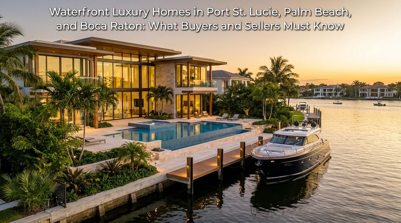
Waterfront Luxury Homes in Port St. Lucie, Palm Beach, and Boca Raton: What Buyers and Sellers Must Know
By Jeannie Jacobson, REALTOR® | RE/MAX Gold | Last reviewed September 2026
Water is the largest single value variable above $1,000,000 in these three markets, and the largest source of cost that does not appear in a listing photograph. What separates a premium from a liability is documentation: depth, access, structures, elevation, and insurability.
Quick Answer. Value on a $1 million-plus waterfront home comes from the type of water, verified ocean access, water depth at mean low water, linear frontage, dock and lift capacity, and elevation. Risk comes from flood zone and base flood elevation, seawall condition and permit status, insurance availability, the coastal construction control line on beachfront parcels, and Florida’s flood disclosure obligation. Both sides are documentable before anyone signs.
This guide is real estate education, not legal, tax, insurance, engineering, surveying, or navigational advice. Market figures vary by source and reporting period and are directional. Water depths, bridge clearances, and navigational routes must be confirmed from a current survey and official navigation sources for any specific property. No flood zone is risk-free, and no specific price, timeline, premium, or outcome can be guaranteed.
What This Guide Covers
- Why Water Is the Largest Value Variable
- The Types of Waterfront and What Each Is Worth to You
- How Waterfront Differs Across the Three Markets
- How Do You Verify Water Depth, Ocean Access, and Boat Fit?
- Seawalls, Docks, Lifts, and Submerged Lands
- Beachfront Property and the Coastal Construction Control Line
- Flood Zones, Elevation, and Insurance
- Buying a Waterfront Home: The Due Diligence Timeline
- Selling a Waterfront Home: Documentation and Disclosure
- FAQ: Waterfront Luxury Homes in Florida
- Conclusion
Related reading: flood zones and insurance on the Treasure Coast • Palm City, an adjacent waterfront market
Why Water Is the Largest Value Variable Above $1,000,000
Two homes with identical square footage, finishes, and lot size on the same street can differ by several hundred thousand dollars because of what sits behind them. Water creates that gap. It also creates costs that never appear in a listing photograph.
The value side is measurable. Type of water, verified route to open water, controlling depth at mean low water, linear feet of frontage, dock dimensions, boat lift capacity, and elevation are all documentable facts. A buyer who can confirm them is buying a known quantity. A buyer who accepts adjectives is buying an assumption.
The cost side is equally concrete. A seawall reaching the end of its service life is a six-figure item. A dock built without permits is a problem that transfers with the deed. Flood zone and base flood elevation drive insurance pricing under a rating methodology that no longer depends on flood zone alone. Beachfront parcels seaward of the coastal construction control line require state permitting for work that would be routine anywhere else. And Florida’s flood disclosure statute obligates sellers to put flood history in writing before a contract is signed.
The three markets have genuinely different water.
Port St. Lucie sits on the St. Lucie River system. The North Fork flows south from St. Lucie County into Martin County, joining the South Fork near Stuart to form the main St. Lucie River, which reaches the Indian River Lagoon and the Atlantic through the St. Lucie Inlet. Much of the city’s extensive canal network, however, is drainage infrastructure rather than navigable water — a distinction covered in detail below, because it decides whether a “waterfront” home floats a boat.
Palm Beach means the Town of Palm Beach on the barrier island, with Atlantic oceanfront on one side and the Lake Worth Lagoon on the other. The Lake Worth Inlet, also called the Palm Beach Inlet, is an artificial cut connecting the northern lagoon to the ocean; it borders the Town on the south and also serves as the entrance channel for the Port of Palm Beach.
Boca Raton has Atlantic oceanfront, the Intracoastal Waterway, Lake Boca Raton, and the Boca Raton Inlet. The City reports 77.18 miles of canals and lakes within its limits and four drawbridges, including the Camino Real, Palmetto Park Road, and Spanish River Boulevard bridges spanning the Intracoastal.
Jeannie Jacobson is a Florida-licensed sales associate with RE/MAX Gold, based in Port St. Lucie, serving from St. Lucie County south into Palm Beach County. Waterfront homes are part of her published service positioning, alongside Treasure Coast luxury homes, new construction, investment properties, and relocation. She is ranked among the Top 1% of Realtors in the United States based on annual production and is fluent in English and Spanish. You can learn more about Jeannie’s background and approach.
This guide is written for both sides. Sections 1 through 6 apply to buyers and sellers equally. Section 7 covers the buyer’s due diligence timeline; Section 8 covers what a seller assembles before listing.
Water Types
The Types of Waterfront and What Each Is Worth to You
“Waterfront” is a category, not a description. The type of water determines boating utility, maintenance exposure, insurance profile, and the size of the resale audience — and those four things rarely move together.
Oceanfront: Direct Beach Frontage
Oceanfront means the property fronts the Atlantic directly. The view is unobstructed and the scarcity is genuine, since the supply of beachfront parcels is fixed.
The trade-offs are structural. Oceanfront property absorbs the highest salt, wind, and storm-surge exposure in these markets, which shortens the service life of exterior finishes, mechanical equipment, and metal components. Parcels partly or wholly seaward of the coastal construction control line face state permitting requirements covered in Section 5. Oceanfront provides beach access, not boating access — a private dock is not a feature of an Atlantic-front parcel, so buyers who want both typically purchase oceanfront and keep a vessel at a marina.
Intracoastal Waterway Frontage
Intracoastal frontage on the Atlantic Intracoastal Waterway is the classic big-water boating product in Palm Beach County. It combines a wide-water view with a protected navigable channel running north and south, and access to the ocean through an inlet.
Value here turns on the specifics: depth at the dock and in the approach, whether any bridge between the property and the chosen inlet is fixed or bascule, and the condition and permit status of the seawall and dock. Wake exposure from channel traffic is a real maintenance consideration on the ICW that interior canal properties do not face.
Lakefront and Lagoon Frontage
This category splits into two very different products, and conflating them is a common and expensive error.
Navigable lagoon and lake frontage — the Lake Worth Lagoon in Palm Beach, Lake Boca Raton in Boca Raton — connects to the Intracoastal system and, through an inlet, to the ocean. It carries real boating utility.
Interior lakes inside gated communities are a different product entirely. They are typically stormwater management features, often with no connection to any navigable system, frequently subject to association rules limiting or prohibiting motorized vessels. They provide a view and a setting, not boating access, and they should be priced as a view amenity. A listing describing an interior community lake as “waterfront” is not necessarily inaccurate, but a buyer who assumes boating value is misreading it.
Riverfront and Canal Frontage
The St. Lucie River system serves Port St. Lucie and the surrounding Treasure Coast. The North Fork carries genuine navigable frontage in places, and the main river connects to the Indian River Lagoon and the Atlantic through the St. Lucie Inlet.
Canal frontage is where the most care is needed. Some canals function as navigable extensions of a river or the Intracoastal. Others are drainage infrastructure with water control structures that make passage to open water impossible. The C-23, C-24, and C-25 canals in the St. Lucie basin were constructed as flood-control works during the mid-twentieth century drainage effort, with the C-24 discharging into the North Fork; they are water-management canals, not navigation routes. Never assume a canal reaches open water. Confirm the specific route on official navigation charts and with a current survey.
A further consideration on the North Fork: it lies within the North Fork St. Lucie River Aquatic Preserve, designated in 1972 and classified as an Outstanding Florida Water. That designation raises the standard applied to dock construction and expansion, which matters to any buyer planning to add or enlarge dockage.
Ocean Access, Water View, and Water Frontage: Insist on Definitions
Three phrases appear constantly in listings and mean different things.
- Water frontage means the parcel boundary meets the water. It says nothing about depth, navigability, or whether a dock is permitted or permittable.
- Water view means water is visible. The water may belong to someone else, may be across a road, and may carry no access rights at all.
- Ocean access means a vessel can travel from the property to the ocean. It is meaningless without two qualifiers: the controlling depth along the route and whether any fixed bridge limits vertical clearance. A property can have genuine ocean access that is useless to a particular boat.
The phrase that matters most to boaters is “no fixed bridges,” meaning every bridge between the dock and the inlet opens. Fixed bridges impose a hard ceiling on vessel height, which eliminates sailboats and larger sportfish boats with towers and outriggers regardless of how deep the water is. Ask for the claim in writing and verify it independently.
| Water type | Boating utility | Typical view | Maintenance exposure | Insurance considerations | Resale audience |
|---|---|---|---|---|---|
| Oceanfront | None from the parcel; vessels kept at a marina | Unobstructed Atlantic | Highest: salt, wind, surge, corrosion | Coastal windstorm and flood exposure; CCCL parcels add permitting | View and beach buyers; scarcity-driven |
| Intracoastal | Strong, subject to depth and bridge clearance | Wide water, channel traffic | High: seawall, dock, wake exposure | Flood zone varies by parcel; elevation matters | Boating buyers; the broadest waterfront audience |
| Navigable lagoon or lake | Real, where connected to the ICW and an inlet | Open water, often protected | Moderate to high | Varies by parcel and elevation | Boating and view buyers |
| Riverfront | Varies; verify route, depth, and preserve rules | Natural shoreline, mangroves | Moderate; dock permitting can be stricter | Varies by parcel and elevation | Boaters and buyers seeking natural setting |
| Navigable canal | Depends entirely on route, width, and depth | Narrow water, neighboring docks | Moderate; seawall condition central | Varies; often lower wake exposure | Boaters at a lower entry point than big water |
| Drainage canal or interior lake | None — verify before assuming otherwise | Water view, often attractive | Lower; usually no marine structures | Still assess flood zone; a view is not a risk rating | View buyers; price as a view amenity |
General characteristics only. Flood zone, insurance availability, boating utility, and permit requirements are parcel-specific and must be confirmed for any individual property. No water type carries a guaranteed flood zone, and no flood zone is risk-free.
Three Markets
How Waterfront Differs in Port St. Lucie, Palm Beach, and Boca Raton
Each market sits on a different water system, uses a different inlet, and applies a different set of local approvals to waterfront improvements. Those three facts shape what a waterfront premium is actually worth in each place.
Port St. Lucie: River, Canals, and the Route to the St. Lucie Inlet
Port St. Lucie’s navigable waterfront is the St. Lucie River system. The North Fork of the St. Lucie River flows south from St. Lucie County into Martin County, where it joins the north-flowing South Fork near Stuart to form the main St. Lucie River. From there the system reaches the Indian River Lagoon and the Atlantic Intracoastal Waterway, and the ocean through the St. Lucie Inlet in Martin County.
That route matters because it means a Port St. Lucie riverfront property’s ocean access runs through another county and a meaningful distance of protected water. It is genuine access for the right vessel. It is not a short run.
The city’s broader canal network is a separate question. The C-23, C-24, and C-25 canals were built as flood-control works in the mid-twentieth century drainage program, with the C-24 discharging into the North Fork, and they operate with water control structures. These are water-management canals. Many neighborhood canals within Port St. Lucie’s platted Sections are likewise part of a drainage system rather than a navigable network. A home can sit on attractive water and have no navigable path anywhere.
Before accepting any ocean-access claim in this market, confirm the specific route on official navigation charts, confirm controlling depth with a current survey or sounding, and confirm that no water control structure sits between the property and open water. Note also that the North Fork lies within the North Fork St. Lucie River Aquatic Preserve, an Outstanding Florida Water, which raises the standard applied to dock permitting.
Oceanfront within St. Lucie County is found on South Hutchinson Island, which frequently carries Fort Pierce mailing addresses despite sitting in the same county. See the Port St. Lucie market overview for orientation, and the Treasure Coast flood zone and insurance guide for how zone designation works locally.
Palm Beach: Oceanfront, the Lake Worth Lagoon, and Town Approvals
The Town of Palm Beach occupies a barrier island roughly 4.2 square miles in area, with the Atlantic on the east and the Lake Worth Lagoon on the west. Properties are oceanfront, lakefront on the lagoon, or interior.
The Lake Worth Inlet, also known as the Palm Beach Inlet, is an artificial cut through the barrier island connecting the northern Lake Worth Lagoon to the Atlantic. It borders the Town of Palm Beach on the south and Palm Beach Shores on the north, and it also serves as the entrance channel for the Port of Palm Beach — so commercial traffic shares the channel. A second inlet, the South Lake Worth Inlet, lies further south.
Approvals are the defining feature of waterfront work on the island. According to the Town of Palm Beach Planning, Zoning and Building Department, design review for non-landmarked buildings is performed by the Architectural Commission (ARCOM), while properties designated as a historic landmark or a historically significant building are reviewed by the Landmarks Preservation Commission (LPC). Projects requiring a variance, special exception, or site plan review go to the Town Council. That structure applies on top of any state and federal marine permitting.
The Town publishes FEMA flood insurance rate maps for the island, segmented into six sections, along with an interactive GIS flood map — a useful resource for confirming a parcel’s zone before making assumptions. For mainland Palm Beach County waterfront context, see the West Palm Beach market overview.
Boca Raton: Intracoastal, Lake Boca Raton, and the Inlet
The City of Boca Raton reports 77.18 miles of canals and lakes within its limits, bordered by the Atlantic on the east. The City has four drawbridges, including the Camino Real, Palmetto Park Road, and Spanish River Boulevard bridges spanning the Intracoastal Waterway. It operates one motorized boat ramp, at Silver Palm Park on Palmetto Park Road at the Intracoastal, and reports no commercial marinas inside city limits, with marinas available north and south of the City.
Lake Boca Raton connects the Intracoastal system to the Boca Raton Inlet, which is crossed by a bascule bridge. Vertical clearance at the inlet bridge and along the Intracoastal is a material constraint for taller vessels, and inlet conditions vary with shoaling. Confirm current clearances and controlling depths from NOAA charts and Coast Guard Local Notice to Mariners rather than from a listing description.
Jurisdiction is the other Boca Raton variable, and it applies to waterfront as much as to anything else. The City of Boca Raton covers the eastern portion including the oceanfront, downtown, and the Intracoastal. West of the city, gated communities use Boca Raton mailing addresses but sit in unincorporated Palm Beach County. Waterfront enclaves inside city limits include Royal Palm Yacht and Country Club, Golden Harbour, Boca Harbour, The Sanctuary, and Por La Mar. Confirm the jurisdiction of any specific address against Palm Beach County Property Appraiser records, because it determines which building department issues marine permits and which local ordinances apply.
Seawalls and marine structures inside the city are addressed in the City of Boca Raton Code of Ordinances, Chapter 22, Marine Structures. Some Florida jurisdictions have adopted minimum seawall elevation or resilience standards; confirm what applies to a specific parcel with the local building department rather than assuming a countywide rule. See the Boca Raton market overview for broader market context.
| Factor | Port St. Lucie (St. Lucie County) | Palm Beach (Town of Palm Beach) | Boca Raton (city and unincorporated west) |
|---|---|---|---|
| Primary water bodies | North Fork and main St. Lucie River; Indian River Lagoon; extensive drainage canal network | Atlantic oceanfront; Lake Worth Lagoon | Atlantic oceanfront; Intracoastal Waterway; Lake Boca Raton; 77.18 miles of canals and lakes |
| Inlet used | St. Lucie Inlet, in Martin County | Lake Worth Inlet (Palm Beach Inlet), shared with the Port of Palm Beach | Boca Raton Inlet |
| Navigation caution | Many canals are drainage works with control structures and no navigable path; verify route | Commercial port traffic in the inlet channel; verify clearances | Bascule bridge at the inlet; confirm clearance and shoaling from official sources |
| Typical $1M+ waterfront | River frontage; South Hutchinson Island oceanfront within the county | Oceanfront estates; lagoon-front homes; condominiums and cooperatives | Intracoastal and canal-front single-family; oceanfront homes and condominiums |
| Key local approvals | City of Port St. Lucie Building Department; aquatic preserve standards on the North Fork | ARCOM; Landmarks Preservation Commission; Town Council for variances | City of Boca Raton development services, Code Chapter 22; or Palm Beach County for unincorporated parcels |
| State and federal layer | Applies in all three: Florida Department of Environmental Protection, the U.S. Army Corps of Engineers, and sovereign submerged lands authorization where required | ||
Sources. Boca Raton canal mileage, drawbridge count, boat ramp, and marina information: City of Boca Raton marine information page, accessed September 2026. Town of Palm Beach review bodies: Town of Palm Beach Planning, Zoning and Building Department, accessed September 2026. St. Lucie basin canal construction and function: South Florida Water Management District St. Lucie River Watershed Protection Plan. Lake Worth Inlet description and Port of Palm Beach channel use: public geographic references, accessed September 2026. Nothing in this table establishes navigability, depth, or clearance for any individual property.
Looking at waterfront inventory across all three markets? Water type, route, and structures vary more between two listings on the same waterway than price alone suggests. Search current waterfront listings and bring the specific addresses you want verified.
Boating
How Do You Verify Water Depth, Ocean Access, and Boat Fit?
Measure controlling depth at mean low water with a survey or bathymetric sounding, confirm the navigational route to the inlet on official charts, and compare every bridge clearance along that route against your vessel’s air draft. Those three checks convert a marketing claim into a fact.
Do them before the inspection period expires, and do them for the route rather than only for the dock.
Mean Low Water Depth at the Dock and Along the Route
Depth claims are only meaningful with a datum and a date. “Five feet of water” is not a specification; “five feet at mean low water as of a sounding dated March 2026” is.
Mean low water is the average of low tide heights over a defined period, and it is the conservative reference because it describes the shallowest routine condition. Depth also changes over time: shoaling from storms and current can reduce a channel that measured adequately two years ago.
The route matters as much as the dock. A property can have ample depth at the seawall and a shallow bar two hundred yards away. Ask for depth along the full path to open water, and remember that your vessel’s draft plus a safety margin is the number that must fit.
Bridge Clearances, Fixed Versus Bascule, and Air Draft
A fixed bridge does not open. Its vertical clearance is a permanent ceiling on vessel height. A bascule bridge opens, on a published schedule or on demand, removing the height constraint but introducing wait times and schedule restrictions.
Your vessel’s air draft is its height above the waterline, including antennas, towers, outriggers, and radar arches. Compare it against the lowest clearance along the entire route, not the nearest bridge. Published clearances are typically stated at mean high water, which means available clearance changes with the tide.
Boca Raton’s City information identifies four drawbridges, three of which span the Intracoastal. The Boca Raton Inlet is crossed by a bascule bridge. Confirm current clearances from NOAA nautical charts and the Coast Guard Local Notice to Mariners rather than from any listing, this guide included.
Travel Time to the Inlet
Listings frequently state a number of minutes to the ocean. Treat it as unverifiable. Actual time depends on vessel speed, no-wake and manatee zones, bridge opening schedules, and traffic.
The verifiable version is the route: the waterways traversed, the distance, the bridges crossed and their type, and the inlet used. Ask for that description, then confirm it on a chart. Better still, run it — Section 7 recommends doing exactly that during the inspection period.
Dock Length, Lift Capacity, and Dock Utilities
Document these specifications rather than accepting impressions:
- Dock dimensions and configuration, and the maximum vessel length the dockage practically accommodates given the waterway width.
- Boat lift capacity in pounds, lift type, cable and motor age, and bunk or cradle condition. Compare rated capacity against your vessel’s fully loaded weight including fuel, water, and gear, not its dry weight.
- Piling condition, including marine borer damage and wrap integrity.
- Dock utilities: shore power amperage and configuration, water, and lighting, and whether the electrical work is permitted and GFCI-protected. Dock electrical is a safety item, not a convenience item.
The Six-Step Verification Sequence
1
Identify your vessel specifications. Length overall, beam, draft, and air draft including all masts, towers, antennas, and arches, plus fully loaded weight. If you plan to upgrade within five years, use the future vessel’s numbers rather than the current one’s.
2
Review the survey and any bathymetric data. Obtain the current boundary survey showing the shoreline, the mean high water line, and marine structures. Request any depth soundings with their date and datum. If none exist, commission a sounding rather than relying on a recollection.
3
Confirm the navigational route. Trace the path from the dock to the inlet on current NOAA charts. Identify every bridge and its type, note controlling depths, and check the Coast Guard Local Notice to Mariners for closures, shoaling advisories, and changed opening schedules.
4
Inspect the dock and lift. Have a qualified marine inspector or contractor examine pilings, decking, fasteners, lift cables and motor, and electrical service. A general home inspector is not trained for marine structures and will usually say so in the report.
5
Confirm permits for existing structures. Dock, lift, and seawall permits from the local building department, plus any Florida Department of Environmental Protection authorization, U.S. Army Corps of Engineers authorization, and sovereign submerged lands lease. Unpermitted marine structures become the new owner’s liability.
6
Obtain a marine contractor’s opinion on what you want to change. If you intend to lengthen a dock, add or upsize a lift, or dredge, ask what is permittable at that location before closing. Aquatic preserve designation, seagrass, and mangroves can make a routine upgrade unapprovable.
Expert Tip: ask for the source and date of any depth figure. Listing descriptions routinely state a depth without a datum or a date, and both change the meaning entirely. A depth measured at high tide is not the number your boat will meet at 6 a.m. in January, and a sounding from four years ago predates whatever the last two storm seasons moved. The correct request is one sentence: “What is the controlling depth at mean low water, who measured it, and on what date?” If no one can answer, that is the answer.
Keep exploring: search current waterfront listings
Structures
Seawalls, Docks, Lifts, and Submerged Lands: Ownership and Permits
Waterfront ownership in Florida involves two distinct things: the upland parcel you own outright, and the water and submerged bottom adjacent to it, which you generally do not. Structures that cross that boundary require authorization from more than one agency.
Buyers frequently assume a dock conveys the way a garage does. It does not, and the difference shows up when a permit file turns out to be incomplete.
Riparian Rights in Plain English
Riparian rights are the rights that attach to land bordering navigable water. In general terms they include reasonable access to the water, the right to an unobstructed view, and the right to wharf out — to build a structure reaching navigable water — subject to regulation.
The limits are the important part. Riparian rights do not convey ownership of the water or the bottom. They do not guarantee that a dock will be approved, or approved at the size you want. They can be constrained by neighboring owners’ corresponding rights, by navigation requirements, and by environmental protections. A riparian right is a right to seek permission, not a permit.
Sovereign Submerged Lands
Florida holds title to sovereignty submerged lands — the bottom beneath navigable waters — in trust for the public. The boundary between private upland and state sovereignty lands is generally at the mean high water line, which is why a current survey showing that line matters on any waterfront purchase.
Structures extending over sovereignty submerged lands generally require authorization. Depending on size, location, and use, that can mean a consent of use, a letter of consent, or a submerged lands lease, administered through the Florida Department of Environmental Protection. Leases carry a term, an annual fee, and conditions, and some require consent or reassignment on transfer — which can add weeks to a closing that nobody planned for.
The practical instruction for both sides: determine early whether a submerged lands authorization exists for the property, what form it takes, what it costs annually, and what happens to it at sale. These are questions for the Florida Department of Environmental Protection and a Florida real estate attorney, not for a listing agent’s recollection.
Permits for Docks and Lifts: Three Independent Layers
Marine construction in Florida typically involves three levels of review, and approval from one does not substitute for another.
- Local. The city or county building department issues the building permit and conducts inspections. In the City of Boca Raton, seawalls and marine structures are addressed in Code of Ordinances Chapter 22; in Port St. Lucie, the City Building Department; for unincorporated Palm Beach County parcels, the applicable county department.
- State. The Florida Department of Environmental Protection administers environmental resource permitting. Many single-family residential docks qualify for an exemption or a letter of authorization based on size, location, and impact, with conditions typically including private use, no obstruction to navigation, and no harm to protected resources. Sovereignty submerged lands authorization is a separate determination.
- Federal. The U.S. Army Corps of Engineers reviews work in navigable waters, frequently under a nationwide permit, with coordination among resource agencies where protected habitat or species may be affected.
Two environmental constraints deserve specific mention because they routinely surprise owners planning improvements. Seagrass beds and mangroves are protected in Florida. Mangrove trimming and removal are regulated, and seagrass presence can determine whether a dock may be extended or reconfigured at all. Do not trim, remove, or clear either without confirming what is permitted for that parcel.
Seawall Condition: What an Engineer’s Report Covers
Seawalls have finite service lives, and replacement is expensive enough to change the economics of a purchase. A general home inspection will not assess one adequately; an engineer’s or qualified marine contractor’s report will.
The components examined include the cap (the concrete beam along the top, checked for cracking, spalling, and separation), the panels (checked for cracking, rotation, and displacement), the tiebacks or anchors (the buried system resisting soil pressure, and the most consequential hidden element), the weep holes (which relieve hydrostatic pressure behind the wall and fail when clogged), and the backfill (where voids, sinkholes, or settlement behind the wall signal soil loss through joints).
Understand the repair-versus-replacement threshold before planning work. Under floodplain and local regulatory frameworks used in Florida jurisdictions, once repair work exceeds a defined proportion of the structure, a project can convert from a repair into a full replacement, triggering structural review, an engineer of record, and state and federal review. A project that begins as patching one failing section can cross that threshold once an engineer opens it up. Confirm the current thresholds with the local building department before construction starts.
Local Seawall Elevation and Resilience Rules
Some Florida jurisdictions have adopted minimum seawall elevation or resilience standards, which can require a replacement wall to be built higher than the one it replaces. Requirements vary by jurisdiction and change.
Confirm what applies to a specific parcel with the local building department — the City of Boca Raton, the Town of Palm Beach, Palm Beach County for unincorporated parcels, or the City of Port St. Lucie. Do not assume a countywide rule, and do not assume the existing wall’s height reflects the current standard.
The Five-Document Structures File
1. Seawall engineering report. A written assessment from a Florida-licensed engineer or qualified marine contractor covering cap, panels, tiebacks, weep holes, and backfill, with remaining service life and any recommended remediation. Sellers who commission one before listing convert the largest buyer unknown into a solved question; buyers without one are pricing a guess.
2. Dock and lift permits with final inspections. The local building permit plus evidence of final inspection or certificate of completion, the Florida Department of Environmental Protection authorization or exemption determination, and any U.S. Army Corps of Engineers authorization. An open or expired permit is a transferable problem; an unpermitted structure is a larger one.
3. Boundary survey showing the mean high water line. A current survey locating the shoreline, the mean high water line, all marine structures, riparian lines, easements, and any encroachment by or onto neighboring property. On waterfront, an old survey is frequently worse than none, because shorelines and structures change.
4. Submerged lands authorization where applicable. The consent of use, letter of consent, or submerged lands lease, including its term, annual fee, conditions, and whether it transfers automatically or requires consent or reassignment. Lease assignment can extend a closing timeline, so identify it in the first week rather than the last.
5. Maintenance and repair records. Invoices and scopes for seawall repairs, dock work, lift service, piling replacement, and any dredging, with dates and contractors. This file also answers the disclosure question honestly: repairs that were made are facts a seller knows, and known material facts that are not readily observable must be disclosed.
Did you know? A submerged lands lease can quietly extend a closing. Where one exists, its transfer may require consent or formal reassignment through the Florida Department of Environmental Protection, and that process runs on the agency’s calendar rather than the contract’s. Identify whether a lease exists in the first week of the contract, not the last, and confirm its term, annual fee, and transfer conditions in writing. Buyers inherit the obligation along with the dock.
Keep exploring: read verified client reviews
Oceanfront
Beachfront Property and the Coastal Construction Control Line
The coastal construction control line is a state-established boundary that triggers additional permitting for construction on sandy beaches. For an oceanfront buyer or seller, whether a parcel sits landward or seaward of it changes what can be built and how long approval takes.
What the CCCL Is and Which Properties It Affects
Under Fla. Stat. § 161.053, construction seaward of the coastal construction control line on sandy beaches requires a permit from the Florida Department of Environmental Protection. The line is established by the state to identify the portion of the beach and dune system subject to fluctuations from a major storm event.
Two points buyers consistently get wrong. First, the line does not follow municipal boundaries or the visible edge of the beach. Whether a specific parcel sits landward or seaward is a question of fact answerable from the state’s own mapping, not from how the house looks relative to the sand. Second, the state requirement and the local building permit requirement are independent — clearing one does not clear the other.
Within a single city, one parcel on the ocean side may sit seaward of the line while a parcel on an interior waterway never encounters it at all, with the local permit requirement identical in both cases and the state requirement applying to only one.
What Requires a CCCL Permit
Activities seaward of the line that may require state authorization commonly include new construction and additions, swimming pools and decks, and certain hardscape, excavation, and landscaping work. Because the scope of what requires authorization is fact-specific, confirm with the Florida Department of Environmental Protection before planning any project on a parcel that is or may be seaward of the line.
For a buyer, the practical question during due diligence is whether existing structures seaward of the line were permitted, and whether any authorization remains open. For a seller, that documentation belongs in the pre-listing file. Never build, repair, excavate, or clear vegetation seaward of the CCCL without confirming permit requirements first.
Dunes, Beach Access, and Sea Turtle Lighting
Dune vegetation stabilizes the beach and dune system and is protected; dune walkovers and beach access structures are typically regulated rather than freely buildable.
Coastal properties may also be subject to exterior lighting requirements during sea turtle nesting season, adopted by ordinance at the municipal or county level rather than through a single countywide rule. Which requirements apply depends on the jurisdiction the parcel sits in. Boca Raton’s sea turtle conservation program, run through the Gumbo Limbo Nature Center, monitors roughly five miles of city beach, and comparable programs and ordinances exist elsewhere along this coast. Confirm the applicable lighting ordinance with the local jurisdiction before specifying exterior lighting on an oceanfront renovation.
Beach Renourishment and Erosion
Beach renourishment — placing sand to restore an eroded beach profile — is carried out along parts of Florida’s southeast coast through programs administered by county and municipal governments with state and federal participation. Projects are periodic rather than continuous, and beach width in front of a specific property varies over time as a result of both natural processes and project timing.
For a buyer, the useful questions are factual: whether the segment fronting the property has been included in past projects, whether any project is currently programmed, and whether the property is subject to any easement associated with renourishment. Those answers come from the county or municipal coastal program, not from an agent’s characterization. This guide does not predict future shoreline change for any property.
Did you know? The CCCL question is answerable before you write an offer, and it costs nothing. Whether a parcel sits landward or seaward of the coastal construction control line is determined from the state’s mapping for that address, and the Florida Department of Environmental Protection administers the permitting program under Fla. Stat. § 161.053. Ask the question during your pre-offer document request rather than during the inspection period, because if your plans involve a pool, an addition, or significant hardscape on an oceanfront parcel, the answer may change whether you want the property at all.
Keep exploring: review recent sales
Risk and Insurance
Flood Zones, Elevation, and Insurance for High-Value Waterfront Homes
Insurance determines whether a waterfront transaction can close and what the property costs to hold. On a $1 million-plus home the state insurer of last resort is generally unavailable, which means coverage comes from the private or surplus lines market and the quote has to be obtained early.
Zones AE, VE, Coastal A, and X
FEMA flood zone designations describe modeled risk and drive lender requirements.
- Zone VE — coastal high hazard area subject to wave action. The most restrictive construction requirements and generally the highest premiums.
- Zone AE — special flood hazard area with a published base flood elevation. Common along the Intracoastal, the Lake Worth Lagoon, and the St. Lucie River system.
- Coastal A zone — an area landward of a VE zone still subject to wave action, where some jurisdictions apply stricter standards than ordinary AE.
- Zone X — outside the special flood hazard area and outside the mandatory purchase requirement.
Zone X is not a no-risk designation. A substantial share of national flood claims come from properties outside high-risk zones, and a mapped zone is a modeled estimate rather than a guarantee about any individual property. Coverage outside a special flood hazard area is optional for the lender’s purposes and frequently still advisable.
Pull the designation for the specific parcel rather than the neighborhood. On peninsulas and along river and lagoon frontage, zone boundaries can cross a single property. The Town of Palm Beach, for example, publishes FEMA flood insurance rate maps for the island in six sections along with an interactive GIS flood map.
Reading an Elevation Certificate
An elevation certificate is a document prepared by a licensed surveyor recording a building’s elevation relative to the base flood elevation, the height floodwater is modeled to reach in a base flood event. The key figure is the lowest floor elevation, along with the elevations of machinery and equipment, and details of any flood openings.
Under FEMA’s current rating methodology, an elevation certificate is not required in order to purchase federal flood coverage, because rating draws on FEMA’s own data sources and on property-specific factors including distance to the water source, flood type, elevation, and rebuild cost. But a policyholder may submit one, and where it shows the structure sits meaningfully above the base flood elevation it can reduce the premium.
That makes the certificate a marketing asset for a seller. A listing that hands a buyer’s agent an elevation certificate lets that buyer obtain an accurate quote instead of assuming a worst case, and buyers price in what they cannot verify. If none exists, a Florida-licensed surveyor can prepare one, typically for a few hundred dollars — among the highest-return pre-listing expenditures on coastal property.
Federal, Private, and Excess Flood Coverage
A homeowners policy does not cover flood damage. Flood is a separate policy, and on a high-value home the federal program alone is generally insufficient.
National Flood Insurance Program residential building and contents coverage is capped at limits well below the rebuild cost of a $1 million-plus home. Confirm the current maximum limits with a licensed Florida insurance agent, then plan for the gap. The usual solutions are private flood insurance, which can write substantially higher limits and sometimes broader coverage, or excess flood coverage layered above a federal policy.
Two federal program features worth knowing: statutory caps limit annual premium increases, with a lower cap applying to primary residences than to non-primary residences, which matters for a seasonal or second home. And communities participating in the Community Rating System earn policyholder discounts based on the community’s classification. Verify current figures with your agent, since both change.
Windstorm Coverage for High-Value Homes
Windstorm is separate from flood and is the other half of the coastal insurance question.
Citizens Property Insurance Corporation, the state-created insurer of last resort, is generally not available at this price band. A 2026 Florida Senate bill analysis states that a personal dwelling must generally have a replacement cost below $700,000 to be eligible, with coverage permitted up to $1 million in counties the Office of Insurance Regulation determines lack sufficiently competitive insurance options, and with Miami-Dade and Monroe treated separately. A $1 million-plus waterfront home will nearly always exceed that threshold on replacement cost alone.
Coverage therefore comes from admitted carriers writing high-value or high-net-worth policies, or from the surplus lines market, arranged through a licensed Florida insurance agent. Carriers evaluate roof age, material, and permit date; opening protection; construction type; four-point inspection findings on older homes; proximity to the coast; and claims history.
Never rely on the seller’s premium as a predictor of yours. Their policy, their claims history, and their coverage limits do not transfer, and pricing at this level is property-specific and individually underwritten. This guide does not estimate premiums for any property; obtain an address-specific quote.
Wind Mitigation Features and Documentation
A wind mitigation inspection, documented on the Florida Office of Insurance Regulation uniform mitigation verification form, records features that can reduce windstorm premiums: roof deck attachment, roof-to-wall connections, roof covering and its permit date, roof geometry, and opening protection.
Its value is asymmetric. For a buyer it produces an accurate quote. For a seller on a well-built home with impact glass and a newer roof, it is direct documentary evidence that the carrying cost is lower than a buyer would otherwise assume. Order it before listing rather than waiting for the buyer to discover the answer.
The Substantial Improvement and Substantial Damage Rule
FEMA’s substantial improvement and substantial damage standard, commonly called the 50 percent rule, holds that when the cost of improvements or repairs equals or exceeds a defined proportion — generally 50 percent — of the structure’s market value excluding land, the entire building must be brought into compliance with current floodplain construction requirements. In a coastal flood zone that can mean elevating the structure.
This matters enormously on older waterfront homes, which are exactly the properties buyers most often intend to renovate. A renovation budget that looks reasonable against a purchase price can cross the threshold against the structure’s value, and the compliance cost that follows is not a line item most buyers have modeled.
Confirm with the local floodplain administrator before committing to a renovation scope on any older property in a special flood hazard area. Ask how the jurisdiction calculates structure value and how it tracks cumulative improvements over time, because both vary.
| Coverage type | What it covers | Who typically provides it | Documents that speed a quote |
|---|---|---|---|
| Dwelling and windstorm | Structure damage including wind; excludes flood | Admitted high-value carriers or surplus lines; Citizens generally unavailable above its replacement-cost threshold | Wind mitigation form, roof permit date, four-point inspection, claims history |
| Federal flood | Flood damage to building and contents, to program limits | National Flood Insurance Program through a participating agent | Flood zone determination, elevation certificate, prior claim history |
| Private or excess flood | Flood limits above the federal program; sometimes broader terms | Private carriers and surplus lines | Elevation certificate, replacement cost estimate, construction details |
| Marine structures | Dock, lift, and seawall, which standard dwelling policies commonly limit or exclude | Endorsement or separate policy; varies by carrier | Permits, engineering report, photos, replacement cost estimate |
| Excess liability | Liability above underlying policy limits, including watercraft where scheduled | High-net-worth carriers | Schedule of underlying policies, vessel details, pool and dock details |
| Scheduled personal property | Art, jewelry, and valuables above standard sublimits | High-net-worth carriers | Appraisals and inventory |
General structure only. Availability, limits, exclusions, and pricing are property-specific and individually underwritten. This guide does not estimate premiums. Work with a licensed Florida insurance agent for address-specific quotes, and confirm current program limits, caps, and eligibility thresholds directly, since all of them change.
Keep exploring: the Treasure Coast flood zone and insurance guide
For Buyers
Buying a Waterfront Luxury Home: The Due Diligence Timeline
Waterfront due diligence adds a marine layer on top of an ordinary luxury purchase, and several items have long lead times. Request documents before you write, then run insurance, marine, survey, and permit work in parallel inside the inspection period.
What to Request Before You Write the Offer
Much of this exists already and costs nothing to ask for. Requesting it pre-offer tells you whether the seller has a documented property or an undocumented one, which is itself information.
- Current boundary survey showing the shoreline, mean high water line, and marine structures
- Elevation certificate, if one exists
- Flood zone determination for the parcel
- Dock, lift, and seawall permits with final inspections
- Any Florida Department of Environmental Protection and U.S. Army Corps of Engineers authorizations
- Any submerged lands lease, with term, fee, and transfer conditions
- Seawall engineering report, if one exists, and marine maintenance records
- Wind mitigation report and roof permit date
- Flood claim history and the seller’s flood disclosure
- For a parcel that may be seaward of the coastal construction control line, any CCCL authorizations
What to Complete Inside the Inspection Period
Run these simultaneously rather than in sequence, because the inspection period is the only window in which you can still cancel and recover your deposit under the “AS IS” version of the Florida Realtors and Florida Bar contract.
Insurance quotes come first. Send the address, year built, roof age and permit date, construction type, flood zone, and elevation certificate to a licensed insurance agent on day one and request windstorm and flood quotes. On waterfront this is the single most common transaction-ending discovery, and it arrives late for anyone who treats it as paperwork.
Then: general home inspection plus four-point on older construction; a separate marine inspection of dock, lift, pilings, and seawall by a qualified marine contractor or engineer; wind mitigation inspection; survey review against the title commitment for easements and encroachments; a permit search with the building department that has jurisdiction; and verification of the navigational route and controlling depth per Section 3.
One additional step worth the cost on any boating purchase: run the route by water during the inspection period, at or near low tide, with the vessel type you intend to keep if possible. Twenty minutes on the water answers questions that no document fully settles.
Appraisal of Waterfront Premiums
Financed waterfront purchases carry appraisal risk that inland purchases do not, because the waterfront premium is difficult to isolate from a small comparable pool.
The strongest technique is paired-sales analysis: comparing a waterfront sale against a comparable non-waterfront sale in the same neighborhood to quantify what the water is actually worth there. It is not always available, and when it is not, adjustment becomes judgment.
Ask your lender whether the appraiser assigned has waterfront experience in that specific market. An appraiser unfamiliar with the area may not know that a fixed bridge two miles downstream changes the buyer pool, or that a canal is a drainage works rather than a navigation route. Supply the appraiser with your comparable analysis and the property documentation where the lender permits it. Questions about a specific loan belong with a licensed mortgage loan originator.
Condominium Waterfront Purchases: Docks and Slips
In a waterfront condominium, the boat slip is frequently the reason for the purchase and frequently the least documented part of it. Slips are held in several different ways, and the differences are substantial.
- Deeded slip — conveyed with the unit or as a separate parcel, and it transfers with the sale.
- Assigned slip — allocated to a unit by the association, potentially subject to reassignment under the governing documents.
- Licensed or leased slip — a revocable or term-limited right, sometimes with a waiting list and a fee.
Confirm in writing which applies, whether it transfers, what it costs annually, and what vessel size and draft it accommodates. Add the building’s milestone inspection status and structural integrity reserve study, which apply to condominium and cooperative buildings three stories or taller, plus any special assessment adopted or under discussion. On a waterfront building, marine structure maintenance is a recurring association expense that shows up in reserves.
The Six-Step Buyer Timeline
1
Pre-offer document request. Ask for the survey, elevation certificate, permits, authorizations, and any engineering report before writing. A seller with an assembled file is a faster transaction; a seller without one tells you where your inspection period will be spent.
2
Contract with a protective inspection period. Set the length by working backward from the marine inspection, the insurance quote, the survey, and the permit search. Marine inspectors and surveyors book out, and association documents take time. Do not shorten below what the insurance quote requires.
3
Insurance quotes in the first days. Windstorm and flood, address-specific, through a licensed Florida insurance agent. Supply the elevation certificate and wind mitigation report if they exist. If the numbers are unworkable, you are still inside your cancellation right.
4
Marine and structural inspections. General inspection plus a separate marine assessment of seawall, dock, lift, and pilings. Verify controlling depth and the navigational route, and run the route by water if you can. Add specialty inspections the property calls for.
5
Survey and title review. Compare the survey against the title commitment with a Florida real estate attorney. Look for easements, encroachments, riparian line issues, and any submerged lands lease requiring consent or reassignment, which can extend the closing timeline.
6
Decide before the period expires. Sort findings into items that affect insurability or safety, genuine deferred maintenance, and cosmetics. Negotiate the first two, and remember that a credit usually serves you better than a seller-managed repair because you control contractor and quality.
Want to see the water, not just the house? Waterfront showings are worth scheduling around tide and light, and the questions worth asking are answered at the dock rather than in the kitchen. Book a private showing and tell us the vessel you intend to keep.
For Sellers
Selling a Waterfront Luxury Home: Documentation, Disclosure, and Marketing
On waterfront, documentation is marketing. The questions a buyer will ask are predictable, and a listing that answers them in advance attracts a different caliber of buyer than one that answers them three weeks into an inspection period.
The Waterfront Documentation Package
Assemble before listing, not after a contract: the elevation certificate; a current boundary survey showing the mean high water line and all marine structures; dock, lift, and seawall permits with final inspections; Florida Department of Environmental Protection and U.S. Army Corps of Engineers authorizations; any submerged lands lease with its term, fee, and transfer conditions; a seawall engineering report; marine maintenance and repair records; the wind mitigation report and roof permit date; and flood claim and insurance history.
Add a one-page specification sheet: water type, the navigational route stated as waterways and bridges rather than as minutes, controlling depth at mean low water with its date and datum, linear feet of frontage from the survey, dock dimensions, lift capacity in pounds, seawall age and condition, flood zone, and lowest floor elevation. Attach it to the listing. Buyer agents will use it, and it gets a property onto shortlists.
Flood Disclosure and the Johnson v. Davis Duty
Two obligations apply together, and neither is optional on waterfront.
Under Fla. Stat. § 689.302, a seller of residential real property must complete and deliver a written flood disclosure to the buyer at or before the time the contract is executed, on a standalone form separate from the contract. The requirement was expanded effective October 1, 2025 by CS/CS/SB 948, Chapter 2025-166, Laws of Florida, and addresses whether the seller has filed a flood-damage insurance claim on the property, whether the seller has received assistance for flood damage from any governmental source, and whether the seller has knowledge of flooding that damaged the property during the seller’s ownership.
Separately, under Johnson v. Davis, decided by the Florida Supreme Court in 1985, a seller of residential property must disclose facts that materially affect value, are not readily observable, and are not known to the buyer. On waterfront that commonly includes known seawall deterioration, unpermitted marine structures, prior water intrusion, dock or lift defects, shoaling, boundary or riparian disputes, and pending regulatory matters affecting the shoreline.
Selling “AS IS” limits your obligation to repair. It does not limit your obligation to disclose. The disclosure is the seller’s to complete; a licensee identifies the requirement and supplies the form but does not fill it in for the client. Legal questions about scope go to a Florida real estate attorney.
Marketing Water Features Accurately
Precision sells better than adjectives at this price point, and it also keeps you out of trouble.
State depth with its date and datum. State bridge information from official navigation sources, identifying bridges as fixed or bascule rather than implying unrestricted passage. Describe the route rather than claiming a travel time. Use linear frontage from the survey rather than an estimate. Never state or imply ocean access, a depth, or a clearance that has not been verified — under Chapter 475, Florida Statutes, licensees owe duties of honesty and fair dealing and must disclose known material facts affecting residential property value that are not readily observable, and advertising must not be misleading.
Aerial imagery is close to mandatory on waterfront, because the property cannot be understood from the ground. Commercial drone operation requires a remote pilot certificate under FAA Part 107; confirm that whoever flies your property holds a current certificate. Add water-perspective photography and video shot from a boat, which almost nobody does and which is exactly the view a boating buyer is trying to imagine.
Pricing the Water Premium When Comparables Are Scarce
Waterfront resists standard comparable analysis because access quality dominates and sample sizes are small.
Prioritize access equivalence over proximity: a sale two miles away with the same bridge situation and comparable depth is a better comparable than the house next door on a canal that dead-ends. Widen the closed-sale window where inventory is thin and apply an explained market-condition adjustment. Use paired sales to isolate the waterfront premium where the data allows. Build marine improvement adjustments from actual contractor estimates, and recognize that a property needing seawall replacement is discounted by more than the repair cost, because buyers price disruption and risk alongside dollars.
Timing Around Hurricane Season and Insurance Availability
Hurricane season runs June 1 through November 30. Two practical effects on a waterfront sale, stated factually: carriers commonly suspend binding new coverage while a named storm is active in the basin, which can delay a closing that depends on an insurance binder; and buyer traffic in these markets strengthens as northern residents arrive for the winter months.
Neither fact makes any particular month produce a better price, and no timing strategy guarantees an outcome. The actionable version is simpler: have the documentation assembled, the marine structures assessed, and the photography completed before the season builds, so the listing launches with the file finished rather than being prepared while it sits.
Keep exploring: request a waterfront home valuation • seller resources • how the selling process works
FAQ
FAQ: Waterfront Luxury Homes in Florida
What is the difference between oceanfront, Intracoastal, and lakefront homes?
Oceanfront property fronts the Atlantic directly, offering beach access and an unobstructed view but no private dock, so boating buyers typically keep a vessel at a marina. Intracoastal frontage sits on the Atlantic Intracoastal Waterway, combining wide water with a protected navigable channel and access to the ocean through an inlet, subject to depth and bridge clearance. Lakefront splits into two very different products: navigable lagoons and lakes such as the Lake Worth Lagoon or Lake Boca Raton connect to the Intracoastal system and carry real boating value, while interior lakes inside gated communities are usually stormwater features with no navigable connection and should be priced as a view amenity.
Are there waterfront homes with ocean access in Port St. Lucie?
Yes, on the St. Lucie River system, but the route must be verified for each property. The North Fork of the St. Lucie River flows south into Martin County, joining the South Fork near Stuart to form the main river, which reaches the Indian River Lagoon and the Atlantic through the St. Lucie Inlet. That is genuine access, though not a short run. Importantly, much of the broader canal network is drainage infrastructure: the C-23, C-24, and C-25 canals were built as flood-control works with water control structures, and many neighborhood canals are likewise not navigable to open water. Never assume a canal reaches the ocean. Confirm the route on official navigation charts and with a current survey.
How do I know if a waterfront home has enough water depth for my boat?
Measure controlling depth at mean low water, which is the conservative reference describing the shallowest routine condition, and insist on the date and datum of any figure you are given. A depth stated without both is not a specification. Check depth along the entire route to open water, not only at the dock, because a property can have ample depth at the seawall and a shallow bar two hundred yards away. Compare the result against your vessel’s draft plus a safety margin. If no current sounding exists, commission one rather than relying on a recollection, and remember that shoaling changes depths over time.
What does “no fixed bridges” mean and why does it matter?
It means every bridge between the property’s dock and the inlet opens, so there is no permanent ceiling on vessel height. A fixed bridge does not open, and its vertical clearance is an absolute limit that eliminates sailboats and larger sportfish boats with towers, outriggers, and radar arches regardless of how deep the water is. Compare your vessel’s air draft, measured including all masts and antennas, against the lowest clearance along the entire route rather than the nearest bridge. Published clearances are typically stated at mean high water, so available clearance changes with the tide. Verify from NOAA charts and the Coast Guard Local Notice to Mariners.
Who owns the submerged land in front of a Florida waterfront home?
Florida holds title to sovereignty submerged lands, the bottom beneath navigable waters, in trust for the public. The boundary between private upland and state sovereignty lands is generally the mean high water line, which is why a current survey showing that line matters on any waterfront purchase. Riparian rights attach to the upland parcel and generally include reasonable access to the water, an unobstructed view, and the right to wharf out subject to regulation, but they do not convey ownership of the water or the bottom. Structures extending over sovereignty lands generally require authorization, which may take the form of a consent of use, letter of consent, or submerged lands lease.
Do I need a permit to repair or replace a seawall or dock in Florida?
Almost certainly, and typically from more than one authority. Marine construction generally involves three independent layers: a local building permit from the city or county, state review through the Florida Department of Environmental Protection including any sovereignty submerged lands authorization, and federal review by the U.S. Army Corps of Engineers for work in navigable waters. Approval from one does not substitute for another. Understand the repair-versus-replacement threshold before planning work, because once repairs exceed a defined proportion of the structure a project can convert into a full replacement requiring structural review and an engineer of record. Confirm current requirements with the local building department first.
What is the coastal construction control line?
It is a state-established boundary identifying the portion of the beach and dune system subject to fluctuations from a major storm event. Under Florida Statutes Section 161.053, construction seaward of the coastal construction control line on sandy beaches requires a permit from the Florida Department of Environmental Protection. Two points matter for buyers and sellers. The line does not follow municipal boundaries or the visible edge of the beach, so whether a parcel sits landward or seaward is a question of fact answerable from the state’s mapping rather than from appearance. And the state requirement is independent of the local building permit requirement, so clearing one does not clear the other.
What does an elevation certificate tell a buyer?
It is a document prepared by a licensed surveyor recording a building’s elevation relative to the base flood elevation, the height floodwater is modeled to reach in a base flood event. The key figures are the lowest floor elevation, the elevation of machinery and equipment, and details of any flood openings. Under FEMA’s current rating methodology an elevation certificate is not required in order to purchase federal flood coverage, since rating uses FEMA’s own data and property-specific factors. But a policyholder may submit one, and where it shows the structure sits meaningfully above base flood elevation it can reduce the premium. For sellers it is a marketing asset, because buyers price in what they cannot verify.
Is flood insurance required on a waterfront home if I pay cash?
The mandatory purchase requirement applies to federally regulated or insured lenders, so a cash buyer is generally not compelled by a lender to carry flood coverage. That does not make it advisable to go without. A homeowners policy does not cover flood damage at all, and on a $1 million-plus waterfront home an uninsured flood loss is a very large uninsured loss. A substantial share of national flood claims come from properties outside high-risk zones, and no flood zone is risk-free. Cash buyers should obtain quotes during the inspection period alongside windstorm coverage, and discuss limits with a licensed Florida insurance agent.
Can I get enough flood coverage on a multi-million-dollar home?
Generally yes, but not from the federal program alone. National Flood Insurance Program residential building and contents coverage is capped at limits well below the rebuild cost of a $1 million-plus home, so high-value waterfront owners typically use private flood insurance, which can write substantially higher limits and sometimes broader terms, or excess flood coverage layered above a federal policy. Confirm current program maximums and private market options with a licensed Florida insurance agent. Documents that speed an accurate quote include the elevation certificate, flood zone determination, replacement cost estimate, construction details, and prior claim history.
What must a Florida seller disclose about past flooding?
Under Florida Statutes Section 689.302, a seller of residential real property must complete and deliver a written flood disclosure at or before the time the contract is executed, on a standalone form separate from the contract. The requirement was expanded effective October 1, 2025 by CS/CS/SB 948, Chapter 2025-166, Laws of Florida, and addresses whether the seller has filed a flood-damage insurance claim on the property, whether the seller has received assistance for flood damage from any governmental source, and whether the seller has knowledge of flooding that damaged the property during the seller’s ownership. Separately, the Johnson v. Davis duty requires disclosure of known material facts that are not readily observable. Selling “AS IS” limits repair obligations, not disclosure obligations.
How does Jeannie Jacobson help clients buy and sell waterfront homes from Port St. Lucie to Boca Raton?
Jeannie Jacobson is a Florida-licensed sales associate with RE/MAX Gold, based in Port St. Lucie, serving from St. Lucie County south into Palm Beach County. Waterfront homes are part of her published service positioning, alongside Treasure Coast luxury homes, new construction, investment properties, and relocation. She is ranked among the Top 1% of Realtors in the United States based on annual production, was voted the 2022 and 2023 People’s Choice Award for Treasure Coast Favorite Realtor, and is fluent in English and Spanish. Her waterfront process is documentation-first: verify water type, route, depth, permits, elevation, and insurability before price rather than after a contract is signed. More detail is available on her Port St. Lucie REALTOR profile.
Conclusion: Water Type, Access, Structures, Elevation, Insurance
Waterfront luxury homes in Port St. Lucie, Palm Beach, and Boca Raton are priced on five things taken together: the type of water, verified access to where you actually want to go, the condition and permit status of the structures at the shoreline, the property’s elevation relative to base flood elevation, and whether it can be insured at a workable cost. Miss any one and the number is a guess.
Each market’s water is genuinely different, and the differences are not cosmetic. Port St. Lucie offers river frontage reaching the Atlantic through the St. Lucie Inlet in Martin County, alongside an extensive canal network much of which is drainage infrastructure with water control structures rather than navigable water. The distinction between the two decides whether a property serves a boat at all.
Palm Beach pairs Atlantic oceanfront with Lake Worth Lagoon frontage and the Lake Worth Inlet, which also serves as the entrance channel for the Port of Palm Beach. Waterfront work on the island passes through the Town’s own review structure, with the Architectural Commission handling design review and the Landmarks Preservation Commission reviewing landmarked and historically significant properties, on top of state and federal marine permitting.
Boca Raton combines oceanfront, the Intracoastal, Lake Boca Raton, and the Boca Raton Inlet across 77.18 miles of city canals and lakes, with four drawbridges and a jurisdictional split between the City and unincorporated Palm Beach County that determines which building department and which ordinances apply to a given address.
For buyers, the sequence is request documents before writing, then run insurance quotes, marine inspection, survey review, and permit search in parallel inside the inspection period. For sellers, it is the same list assembled before listing, because on waterfront the documentation is the marketing.
One instruction applies to everyone on both sides: verify rather than accept. Depth needs a datum and a date. Ocean access needs a route and a clearance. A dock needs a permit file. An elevation needs a certificate. Every one of those is obtainable before anyone signs anything.
If you are buying or selling waterfront in any of these three markets, the useful first step is a conversation about the specific water — yours or the one you are considering.
Buying or Selling Waterfront on Florida’s East Coast?
Bring us the address and the vessel, or the property you are preparing to list, and we will tell you what the file is missing.
This article is general real estate education reflecting information believed accurate as of September 2026. It is not legal, tax, financial, insurance, engineering, surveying, environmental, or navigational advice. Market figures vary by source, geographic definition, and reporting period and are directional rather than definitive. Water depths, bridge clearances, navigational routes, flood zone designations, permit requirements, seawall standards, insurance eligibility thresholds, and statutory requirements change and are property-specific; confirm each for any individual parcel from a current survey, official navigation sources, the applicable permitting agencies, and licensed professionals. No flood zone is risk-free. Results vary by property, financing, competition, condition, and contract terms, and no specific price, timeline, premium, permit approval, or outcome can be guaranteed. Real estate compensation is negotiable and set by written agreement; no rate is standard or established by law. Consult a Florida real estate attorney, a licensed Florida insurance agent, a Florida-licensed surveyor and engineer, and the Florida Department of Environmental Protection regarding your specific situation. Equal Housing Opportunity. We comply with the Federal Fair Housing Act and the Florida Fair Housing Act.
Jeannie Jacobson, REALTOR® | RE/MAX Gold | Ranked among the Top 1% of Realtors in the United States
Trusted Port St. Lucie / Port Saint Lucie Real Estate Agent ( Buyer’s & Listing Agent )
Treasure Coast Luxury Homes | Waterfront Homes | New Construction | Investment Properties | Relocation
Cell: 772-877-0268 | Office: 561-926-3551
jeanniemjacobson@gmail.com | jeanniehomesforsale.com | About | Reviews | Contact
10850 S US Hwy 1, Port St Lucie, FL 34952 | FL Lic #SL3516612
English | Español