

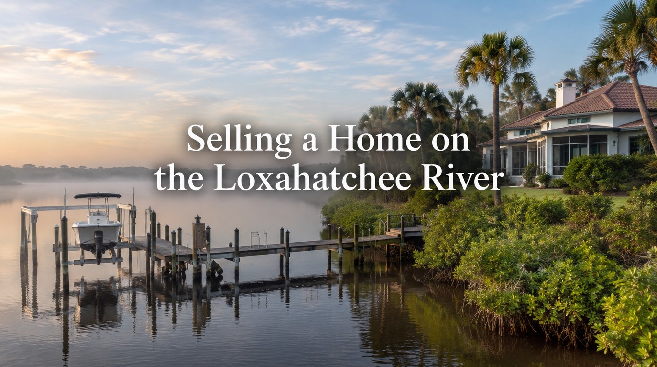
Selling a Home on the Loxahatchee River
A home on the Loxahatchee River in Jupiter or Tequesta sits inside an aquatic preserve, behind a railroad drawbridge, in manatee zones that change by fork and by season, and under a Town dock rule that caps how far any structure can reach into the river. Buyers and their marine consultants will check every one of those facts. This guide shows which river rules, dock permits and access facts to document before the listing goes live, and which local office holds each record.
Seller Answer in Brief
Before listing a Loxahatchee River home in Jupiter or Tequesta, document four things: the fork and jurisdiction the parcel sits in, the permit history of the dock and lift, the measured water depth at the dock and along the route to the inlet, and the manatee speed zones a boat must pass through. River frontage carries rules the Intracoastal does not, so buyers price these facts directly.
- The Loxahatchee River-Lake Worth Creek Aquatic Preserve was designated in 1970 and covers about 1,800 acres, including the Central Embayment and the forks (Florida Aquatic Preserves program, accessed October 2026).
- Town of Jupiter Code Sec. 27-2626(b)(1) limits a dock in a natural waterway to 50 feet from the mean high water line or 20 percent of the waterway width, whichever is less.
- Rule 68C-22.009 sets a year-round slow speed zone within 300 feet of the river shoreline west of the FEC railroad bridge and a seasonal slow speed zone from November 15 to March 31 on most of the river outside the posted channel.
- The Town of Jupiter dock checklist (revised January 2021) lists SFWMD approval for structures in natural waterways and names the Loxahatchee River.
- Tequesta’s dock submittal list (July 2024) applies Chapter 76, Division 1, to lots on the Loxahatchee River and limits protrusion to 10 feet past the waterward extension of the neighbor’s side line.
- The Jupiter Inlet District, created in 1921, maintains the navigation channels in the Central Embayment and the North, Northwest and Southwest forks.
In this guide
- Why a Loxahatchee River listing in Jupiter is not an Intracoastal listing
- Which part of the river is the property on
- Manatee speed zones by fork, and what they do to a buyer’s run time
- The route to Jupiter Inlet: bridges, channels and the sand trap
- How depth is verified at a river dock
- Dock permits in the Town of Jupiter: what the file should show
- Tequesta frontage: Chapter 76 and the Village Building Department
- The state layer: Outstanding Florida Waters, the dock exemption and the Wild and Scenic corridor
- Sewer, septic, flood and parcel records for river homes
- Pricing river frontage in Jupiter by segment
- The documentation sequence before photos are scheduled
- Frequently asked questions
Why a Loxahatchee River listing in Jupiter is not an Intracoastal listing
Many owners assume that waterfront in Jupiter is one category with one set of rules. The Town’s own dock code partly supports that view. Sec. 27-2626(b)(1) treats every natural waterway the same way: no dock, mooring space or mooring piling may extend more than 50 feet from the mean high water line, and none may exceed 20 percent of the natural waterway width, whichever is less (Town of Jupiter, Application for Dock Waiver). The Town’s dock checklist lists the Loxahatchee River, the Intracoastal Waterway and Sawfish Bay together as natural waterways (Town of Jupiter Building, Docks checklist).
So on the narrow question of how far a dock can reach, the river and the Intracoastal start from the same Town rule. Everything around that rule is different.
The river and its forks sit inside the Loxahatchee River-Lake Worth Creek Aquatic Preserve, designated by the state in 1970 and covering roughly 1,800 acres in Palm Beach and Martin counties, bordered by Jupiter and Tequesta (Florida Aquatic Preserves, Loxahatchee River-Lake Worth Creek). The preserve is managed through the Indian River Lagoon Aquatic Preserves office of the Florida Department of Environmental Protection. Seagrass beds and oyster bars are listed among its submerged resources, and seagrass damage can bring a fine of up to $1,000 under the same program page.
Upstream, the Northwest Fork carries a federal Wild and Scenic River designation dated May 17, 1985. The National Wild and Scenic Rivers System lists 7.6 designated miles, split into 1.3 wild, 5.8 scenic and 0.5 recreational, running from Riverbend Park downstream to Jonathan Dickinson State Park (National Wild and Scenic Rivers System, Loxahatchee River). Other agency pages cite different mileage for the same designation, which is a good reason to work from the corridor map rather than a remembered number.
Then there are the speed zones. The state manatee rule for Palm Beach County draws its river boundaries at the FEC railroad bridge, the Tequesta Drive bridge on the North Fork and the Loxahatchee River Road bridge on the Southwest Fork, and it adds a seasonal layer from November 15 to March 31 (Fla. Admin. Code R. 68C-22.009). A dock on the Intracoastal in Jupiter is not inside those river boundaries.
The seller consequence is direct. A buyer comparing a river home with an Intracoastal home is comparing two different sets of travel times, two different permitting files and two different environmental settings. The listing needs to present the river facts accurately and early, before a buyer’s marine consultant presents them in a less favorable order.
For the buyer side of Jupiter boating access, the site’s guide to Jupiter waterfront homes and boating access covers how buyers compare water types. This article stays on the seller’s documentation.
Which part of the river is the property on
The first document is a simple one: a map that places the parcel on the correct reach of the river. The aquatic preserve program describes a Central Embayment fed by three tributaries, the North Fork, the Northwest Fork and the Southwest Fork. Each reach has its own boundary markers in the manatee rule and, in some cases, a different permitting government.
The Central Embayment is the wide water west of the inlet. Homes here are closest to the FEC railroad bridge and to the inlet itself. The North Fork runs north toward Tequesta, and the manatee rule uses the Tequesta Drive bridge as a boundary. The Northwest Fork leads upstream toward the county line and the Wild and Scenic corridor. The Southwest Fork runs toward the Loxahatchee River Road bridge, where the C-18 Canal continues west to Structure S‑46.
Jurisdiction does not always follow the street address. A Jupiter mailing address can sit in unincorporated Palm Beach County, and the upstream Northwest Fork reaches Martin County. The building and zoning office that issued the dock permit depends on where the parcel sits, so the property appraiser record is the place to confirm it before ordering permit files. The Palm Beach County Property Appraiser shows the municipality for each parcel control number.
| River reach | Boundary named in Rule 68C‑22.009 | Likely dock permitting office | What the seller should document |
|---|---|---|---|
| Central Embayment, Jupiter side | West of the FEC railroad bridge (adjacent to the SR 811 bridge) | Town of Jupiter Building, 210 Military Trail | Distance to the FEC bridge, channel marker nearest the dock, depth at the dock |
| Central Embayment and North Fork, Tequesta side | Confluence north to the Tequesta Drive bridge, and north of it to the county line | Village of Tequesta Building Department, 345 Tequesta Drive | Chapter 76 Division 1 compliance, survey date, side line protrusion |
| Northwest Fork | West and northwest to the Palm Beach and Martin county line | Town of Jupiter, Palm Beach County or Martin County, by parcel | Jurisdiction from the appraiser record, Wild and Scenic corridor map, controlling depth downstream |
| Southwest Fork | Confluence west to the Loxahatchee River Road bridge | Town of Jupiter or Palm Beach County, by parcel | Bridge clearance at Loxahatchee River Road, depth at the dock and in the fork channel |
| C-18 Canal | Loxahatchee River Road bridge west to Structure S‑46 | By parcel | Whether the frontage is canal or river under local code, since projection rules differ |
Source for the boundaries: Fla. Admin. Code R. 68C-22.009. Office assignments are general and must be confirmed parcel by parcel.
That last row matters more than it looks. The Town of Jupiter checklist sets a different projection rule for man-made waterways: 5 feet or 10 percent of canal width from the high water line, whichever is greater. A lot that a buyer thinks of as river frontage may be classified as canal frontage for dock purposes, and the dock a buyer imagines may not be permitted. Owners should know which category applies before anyone describes the dock potential in marketing.
A one page map with the parcel, the reach, the nearest bridge and the nearest marked channel answers the first question every serious buyer asks. It also prevents a common listing error: describing a Northwest Fork home with the inlet travel time of an Embayment home.
Manatee speed zones by fork, and what they do to a buyer’s run time
Do the river speed zones apply all year? Some do and some do not, and the difference changes how long a boat takes to reach Jupiter Inlet.
Rule 68C-22.009 creates three year-round slow speed zones relevant to the river (Fla. Admin. Code R. 68C‑22.009):
- All waters within 300 feet of the shoreline in the Loxahatchee River, including backwaters and canals, from the FEC railroad bridge west to the Loxahatchee River Road bridge on the Southwest Fork, to the county line on the Northwest Fork and to the Tequesta Drive bridge on the North Fork.
- All waters of the C-18 Canal from the Loxahatchee River Road bridge west to Structure S‑46.
- All waters of the North Fork from the Tequesta Drive bridge north to the county line, excluding the main marked navigation channel.
The seasonal zones apply between November 15 and March 31 each year. They cover the river from the northwest end of the FEC railroad bridge west and northwest to the county line, excluding the main posted channel to within one-eighth mile west of the bridge; the North Fork from the confluence to the Tequesta Drive bridge, excluding the posted channel; and the Southwest Fork from the confluence to the Loxahatchee River Road bridge.
Read together, the rule means a boat leaving almost any river dock starts inside a slow speed zone, because a dock is by definition within 300 feet of the shoreline. In the winter months, more of the trip stays slow. The rule history shows the text was last amended in 1993, but owners should still read the current version before quoting it, since state rules change.
For pricing, this is not a defect to hide. It is a measurable fact. Many river buyers are choosing the river for calmer water and natural shoreline, and they expect slow zones. What they do not accept is a listing that implies a fast run to the inlet and a showing that reveals a long idle. The fix is to document it honestly.
A practical method: run the route from the dock to the inlet twice, once inside the seasonal window and once outside it, at a normal cruising speed where allowed and at slow speed where required. Record the time, the date, the tide stage and the boat used. This is the seller’s own observation, not a published figure, and it should be labeled that way in any listing material. It gives buyers a realistic number and gives the pricing analysis a way to compare a Northwest Fork home with an Embayment home on the same basis.
The posted signs are the field version of the rule. Photographs of the nearest zone signs, with their locations, belong in the river file. A buyer’s agent who sees them in the documents before the showing has fewer surprises to report afterward.
The route to Jupiter Inlet: bridges, channels and the sand trap
Every river dock reaches the ocean through the same short corridor at the river mouth, and three public facts about that corridor belong in the seller’s file.
The FEC railway bridge at mile 1.2
The Florida East Coast Railway bridge across the Loxahatchee River at mile 1.2 is regulated by 33 CFR 117.299. The bridge is not constantly tended. The draw normally stays fully open with flashing green lights. When a train approaches, the lights turn to flashing red, a horn sounds, and after an eight minute delay the draw lowers if the scanners show nothing under it. It stays down for eight minutes or while the approach track circuit is occupied, then reopens (33 CFR 117.299).
A 2003 Federal Register notice described the bridge as a single-leaf bascule with 4 feet of vertical clearance above mean high water in the closed position and 40 feet of horizontal clearance. That is an older description and should be confirmed against the current chart, but the practical point holds: when a train is crossing, nearly every boat waits. Buyers who boat often will ask about it. A seller who has noted the typical wait during actual trips can answer with experience rather than a guess.
The road bridges
The FEC bridge sits beside the SR 811 (Alternate A1A) bridge, and the route toward the inlet also passes the US 1 bridge near the river mouth. The Florida Department of Transportation states that it has replaced the US 1 bridge over the Loxahatchee River with a twin double-leaf drawbridge that provides up to 42 feet of vertical clearance and a navigable channel width of 125 feet, and lists project completion as December 2025 (FDOT, US 1 Bridge Replacement Project, accessed October 2026). For the SR 811 bridge, take the closed vertical clearance from the current NOAA nautical chart for the Jupiter Inlet area and check the U.S. Coast Guard District 7 Local Notice to Mariners in force when the listing launches. Put the figure on the listing data sheet with the chart edition or notice number beside it, because a buyer with a tower boat will compare it with the boat’s air draft before booking a showing.
On the forks, the bridges named in the manatee rule are also the bridges that limit boat height upstream. A Southwest Fork home west of the Loxahatchee River Road bridge, for example, has every trip pass under that bridge. Its clearance at mean high water belongs on the listing data sheet, measured or charted, with the source named.
Who maintains the channels
The Jupiter Inlet District is a special taxing district created by the Legislature in 1921. By its charter, it maintains the navigation channels in the Central Embayment and the North, Northwest and Southwest forks, and it maintains channel markers in the Main and South channels and on the forks. It also dredges the inlet sand trap; its 2026 project removed about 176,000 cubic yards of sand by hydraulic dredge, with dredging and placement completed on April 26, 2026 (Jupiter Inlet District, 2026 sand trap project; Jupiter Inlet District, About).
Why should a seller care about a dredging project at the inlet? Because the buyer’s question is not only “how deep is the dock” but “how deep is the route.” The District’s project records and channel marker maintenance are public evidence that the river channels are actively managed. They do not promise a depth at any private dock. A seller can cite them for what they show, and no more.
The District’s office is at 400 N. Delaware Blvd. in Jupiter. Its navigational aids page and project news are the first places to check for any active work near the route a buyer would use during the listing period.
How depth is verified at a river dock
Depth is the river fact buyers argue about most, and the one most often stated without support. A number in a listing remark (“five feet at the dock”) means little unless it says where it was measured, against what tide datum and by whom.
The Town of Jupiter already tells owners what a credible depth record looks like, because it asks for one in its own forms. Dock plans submitted to the Town Building department must show Mean Low Water and specify whether and where the bottom is exposed (Town of Jupiter, Docks checklist). The Town’s dock waiver application goes further. It asks for a bathymetric survey, depth contours, water depth at the dock, at the boat lift and within the navigable channel, a minimum 15 foot unobstructed navigable channel waterward of the boat mooring space, and the total projection of the dock and mooring space waterward of mean high water (Town of Jupiter, Application for Dock Waiver).
That list is a good template for a seller’s depth record even when no waiver is planned. It separates three different depths that buyers often blur together:
| Depth measure | What it answers | How to document it |
|---|---|---|
| Depth at the dock face and lift | Can the buyer’s boat sit at the dock at low tide? | Soundings by a licensed surveyor, reported to Mean Low Water, with the date of the survey |
| Depth between the dock and the marked channel | Can the boat get from the dock to the channel at low tide? | Bathymetric survey with depth contours across the approach, as the Town waiver form describes |
| Controlling depth along the route to the inlet | What is the shallowest point the boat must cross? | Current chart and Jupiter Inlet District channel information, cited by date; not a seller estimate |
The third measure is the one sellers should be most careful with. A seller can measure the first two on the property. The route depth belongs to the public channel, it changes with shoaling and dredging, and the source should be quoted rather than restated as a promise.
Timing matters too. The Town requires a survey dated within six months of a dock permit application under Sec. 27-2626, so a recent survey has a second use if the buyer plans dock work. A survey ordered six to eight weeks before listing is usually still current when a buyer’s contractor wants to apply, though the buyer’s permit timeline is the buyer’s to manage.
One more point on language. “Deep water” in a river listing invites a dispute unless a draft is attached to it. Better: state the measured depth at Mean Low Water at the dock, the survey date and the name of the surveyor, and let the buyer compare it with the draft of their own boat.
Dock permits in the Town of Jupiter: what the file should show
Can a buyer add, enlarge or replace a dock on a Jupiter river lot? The answer starts with what is already permitted, which is why the existing dock’s permit history is the most valuable single document a river seller can produce.
The Town of Jupiter Building department, at 210 Military Trail, permits docks as “Marine Structure” applications. Its checklist, revised January 2021, asks for the following (Town of Jupiter, Docks checklist):
A signed and sealed survey within six months
Showing existing and proposed seawall, dock, mooring spaces and any existing lift with all dimensions; setbacks from dock and mooring spaces to side property lines; the mean high water line in NAVD88; and the width of the waterway at the dock. On natural waterways the checklist restates the projection limit: 20 percent of waterway width or 50 feet, whichever is less.
Engineered plans
Signed and sealed plans showing framing, a typical section, piling penetration depth, connectors, ramps, stairs and rails, plus Mean Low Water and any exposed bottom.
Supporting documents
An owner and builder affidavit where it applies, and photographs of the entire affected water frontage taken from land.
Agency approvals
Florida Department of Environmental Protection approval or self certification of exemption; U.S. Army Corps of Engineers approval if not included in the DEP approval; and South Florida Water Management District approval where the structure is on submerged lands below mean high water or in a natural waterway, which the checklist says includes the Loxahatchee River.
Electrical and plumbing permits are required before that work starts, so a lift with power should have its own electrical permit on file. The checklist also warns that the Building department cannot enforce association rules; in a deed restricted community, association approval is a separate step.
The Town code adds more limits beyond projection. The waiver form quotes Sec. 27-2626(b)(6) on side setbacks, (b)(7) on shared docks between two contiguous single family or duplex lots, (b)(10) limiting dock shapes to rectangular, “T” and “L” configurations unless the Director approves another, and (b)(15), which requires that 50 percent of the waterway width stay unobstructed at the centerline, with a 15 foot channel as the fallback the Director can accept (Town of Jupiter, Application for Dock Waiver).
Waivers exist. The Director of Planning and Zoning decides them after a Natural Resources recommendation that checks navigation and views, safety, environmental impact and consistency with the Comprehensive Plan’s Conservation Element Policy 1.4.21 and Coastal Management Element Policy 1.5.10. A buyer who wants a longer dock on a narrow reach of the river is asking for a waiver, not a routine permit, and the outcome is the Town’s to decide. A listing should never describe a waiver as available or likely.
What the seller’s file should contain, then: the permit number and final inspection for the existing dock and lift, the as-built survey if one was required, the DEP and SFWMD authorizations or exemption verification, and any waiver granted. If any piece is missing, the time to find out is before listing. The site’s guide to open permits when selling explains how unclosed permits surface at closing.
Tequesta frontage: Chapter 76 and the Village Building Department
On the Tequesta side of the river, the permitting office and the rule set change. The Village of Tequesta Building Department, at 345 Tequesta Drive, publishes its own dock and boat lift submittal list, dated July 2024 (Village of Tequesta, Dock and Boat Lift Permit Submittal Requirements).
The list ties the site plan to Chapter 76 of the Village code, Waterway Control. Division 1 covers lots adjacent to the Loxahatchee River waterway or the Intracoastal Waterway; Division 2 covers canals. A river lot in Tequesta falls under Division 1.
The protrusion rule on the Tequesta list is worded differently from Jupiter’s. No marine structure may be placed, and no watercraft may be docked, moored or held on a lift, so that it protrudes more than 10 feet beyond the waterward extension of the adjacent property’s side line. Jupiter measures mainly outward from mean high water; Tequesta’s list focuses on how far a structure or boat crosses toward the neighbor’s water. A buyer planning a larger boat on a Tequesta river lot needs to check both the boat’s beam and its position on the lift against that line.
Other Tequesta items the seller can prepare in advance:
- A survey signed and sealed by a professional land surveyor. If it is older than one year, the Village requires a signed and notarized survey affidavit.
- The location of mooring pilings and their height at the high water line, with reflective devices on all sides no more than 2 feet below the top.
- A DEP permit or self certification approval.
- An electrical permit for a boat lift, with an electrical riser detail and the conductor type, size and amperage of the branch feeder.
- A final survey locating free standing pilings, which may be required before final inspection.
For a seller, the Tequesta list is also a checklist for what a buyer will ask to see. A lift installed without the electrical permit, or pilings without reflectors, are small items that look larger in an inspection report. Correcting them before listing is usually simpler than negotiating them later.
The Village market itself is covered in the site’s article on Tequesta real estate at village scale. For river frontage specifically, the Chapter 76 Division 1 rules and the North Fork manatee boundary at the Tequesta Drive bridge are the two local facts that separate a Tequesta river listing from a Jupiter one.
The state layer: Outstanding Florida Waters, the dock exemption and the Wild and Scenic corridor
State law appears in a river listing only where it changes what a Jupiter or Tequesta owner, or the next owner, can do at the water. Three state level facts do that on the Loxahatchee.
The 500 square foot threshold
Section 403.813(1)(b), Florida Statutes, exempts certain private docks from a state environmental resource permit. The size limit depends on the water: 500 square feet or less of over-water surface area in Outstanding Florida Waters, or 1,000 square feet or less elsewhere. The dock must stand on pilings or float without fill or dredging beyond the pilings, must not impede flow or create a navigational hazard, must be used for recreational, noncommercial mooring, and must be the only exempt dock along 65 feet of shoreline unless the platted lot is shorter (s. 403.813, F.S., 2026).
Why this matters on the river: DEP’s aquatic preserve data describes all aquatic preserves as also designated Outstanding Florida Waters (Florida DEP, Aquatic Preserves map service). A river dock inside the preserve that relied on the exemption would therefore face the 500 square foot limit, not 1,000. The state rule that lists Outstanding Florida Waters names waters in aquatic preserves created under Chapter 258 as Outstanding Florida Waters, and lists the Loxahatchee River-Lake Worth Creek preserve by name in Martin and Palm Beach counties (Fla. Admin. Code R. 62-302.700(2)(f) and (9)(h)). Whether a particular dock site falls inside the designated boundary is a mapping question for DEP, so ask for that answer with the exemption verification rather than assuming it. The Town of Jupiter checklist asks for the DEP self certification of exemption verification for exactly this reason.
For the seller, the practical step is to locate the exemption verification or permit for the existing dock and note its over-water area. A buyer who wants a larger terminal platform should know whether the dock already sits at the threshold.
Sovereign submerged lands and riparian lines
The Town checklist requires SFWMD approval when a structure sits on submerged lands below the mean high water line. The Town waiver form also asks for riparian lines established by jurisdictional agencies where they apply. On a curved river shoreline, riparian lines rarely run straight out from the lot lines. A dock that looks well inside the property on the survey may be close to a riparian line on the water. If the existing authorizations show a riparian line, that drawing belongs in the file. A marine permitting consultant should confirm any question here before it reaches a buyer.
The Wild and Scenic corridor and the Coordinating Council
The federal designation of the Northwest Fork is managed with the State of Florida through Jonathan Dickinson State Park and the National Park Service Southeast Regional Office, and the national listing posted a management plan update in June 2025 (National Wild and Scenic Rivers System, Loxahatchee River). At the state level, the Loxahatchee River Management Coordinating Council was established by Chapter 83-358, Laws of Florida. It advises DEP and the South Florida Water Management District on administration of the river and is responsible for the Loxahatchee River Management Plan (Loxahatchee River Management Coordinating Council).
Does the designation restrict a private home? It does not replace local zoning, and most of the wild segment runs through public land in the state park. For a parcel on or near the upstream Northwest Fork, though, the corridor map and the management plan are the documents a buyer’s attorney may request when the buyer plans waterfront work. A seller with a property in that reach should have the corridor map page that shows the parcel, and should leave interpretation of what is allowed to the agencies and the buyer’s consultant.
Mangroves and seagrass
Natural shoreline is part of what river buyers pay for, and it comes with rules. The aquatic preserve program lists seagrass and oyster bars among the protected resources, and the Town waiver form asks for existing mangroves on the survey. Mangrove trimming falls under the state Mangrove Trimming and Preservation Act. Before any trimming, ask the DEP Southeast District office whether the state or a local government with a delegated program handles mangrove trimming at your address, and get the answer in writing. Any recent trimming should have its authorization in the file, and no trimming should be done for listing photos without one.
Sewer, septic, flood and parcel records for river homes
Three records sit beside the dock file and get requested in nearly every river transaction in Jupiter and Tequesta.
Sewer or septic
The Loxahatchee River District, created by the Legislature in 1971, is the wastewater utility for much of the Jupiter and Tequesta area. By 2016 it had converted nearly 4,000 homes in its service area from septic tanks to centralized sewer, and the South Florida Water Management District noted that septic systems in sandy soil with high water tables can release phosphorus into nearby water bodies (SFWMD, Loxahatchee River District proclamation, September 2016). The District, at 2500 Jupiter Park Drive, also runs the WildPine Ecological Laboratory and publishes a Water Quality Scorecard for the river.
A river seller should know, with a document, whether the home is connected to District sewer or still on septic, and if on septic, whether sewer is available in the street. Availability changes street by street, so ask the District’s customer service for a written answer for the parcel. Buyers on the river often care about this for environmental reasons as well as cost, and lenders and insurers may ask. Septic records, pump-out dates and any inspection belong in the file.
Flood records
River lots in Jupiter range from elevated bluffs to low shoreline, so flood zone and elevation vary within the same street. The current effective map is on the FEMA Flood Map Service Center. An elevation certificate, if one exists, should be ready. Florida’s flood disclosure statute, s. 689.302, requires a seller of residential property to give buyers a flood disclosure form covering prior flood insurance claims and federal flood assistance, among other items; the site’s guide to flood disclosure for home sellers covers the form. The local part is the evidence: the zone, the elevation and the claim history for this lot.
Parcel and jurisdiction records
The Palm Beach County Property Appraiser record confirms the municipality, the legal description and the lot dimensions along the water. For parcels on the upstream Northwest Fork in Martin County, the Martin County records serve the same purpose. Whether the legal description runs to the mean high water line, to a platted line or into the water is a title question that a real estate attorney or title agent should answer; the seller’s task is to have the deed, the survey and the title commitment in one place so the question can be answered early.
General disclosure duties apply too, and the site’s guide to seller disclosure requirements explains them. On the river, known facts about the dock, the seawall or shoreline, past flooding and septic condition are the items most likely to be material.
Pricing river frontage in Jupiter by segment
Two Loxahatchee River homes with similar houses can be worth very different amounts, and the difference usually traces back to the facts in the earlier sections: which reach, which bridges, how many minutes in slow speed zones, what depth at Mean Low Water, and what dock the rules allow.
This guide states no sale counts or median prices for river frontage. The Property Appraiser’s sales search has no filter for river frontage, so a count built from it would depend on hand-picking parcels, and the list price and marketing time for these homes sit in the MLS, which is not used here. What follows is the method a written pricing analysis should use and the figures a seller should ask for.
Method
- Data: closed single family sales with Loxahatchee River frontage in the Town of Jupiter, the Village of Tequesta and unincorporated Palm Beach County along the forks, from an authorized MLS export, cross checked against the property appraiser’s sales records.
- Period: the most recent 24 months of closed sales.
- Grouping: by reach (Central Embayment, North Fork, Northwest Fork, Southwest Fork), because the speed zones, bridges and channel depths differ by reach.
- Top tier: if few river sales reach $3 million, the top tier is defined as the top 10 percent of river frontage sales by price in the period, and the definition is stated with the sample size.
- Adjustments: dock and lift permitted status, measured depth at Mean Low Water, frontage length, and whether the lot counts as natural waterway or canal frontage under local code.
Which figures to ask for, and how each changes the decision
Start with recorded sales. The Palm Beach County Property Appraiser’s Advanced Sales Search returns qualified sales by subdivision, municipality or street, with the recorded price and date. Ask your listing agent to pull the river subdivisions on your reach for the last 24 months, then mark which parcels actually touch the river on the appraiser’s map. The resulting count tells you how much weight the reach can carry on its own. If a fork has only a handful of sales in 24 months, the analysis borrows from adjacent reaches and adjusts for the documented differences rather than treating a single sale as a price ceiling.
Then ask the listing agent for an MLS report on the same parcels showing original list price, final list price, days to contract, the ratio of sale price to final list price, any price reductions, and the river listings that expired or were withdrawn. Days to contract show how long buyers took to accept the river tradeoffs in that reach at the price asked. A low sale to list ratio shows how much room buyers expected to negotiate. Expired listings show prices the reach did not support. Finally, ask for the river listings active today on your reach and the next one over: those homes are your direct competition on launch day. The top tier threshold, defined from the same 24 months, tells you whether the home competes inside the river’s upper segment or against the broader Jupiter waterfront market, including Intracoastal homes that buyers will cross shop.
This is where documentation becomes price. A comparable sale with a permitted dock, a recent survey and measured depth is a cleaner comparison than one with unknown permit status. When the seller’s own file is complete, the pricing analysis can compare like with like, and the buyer’s appraiser has fewer reasons to discount.
Timing interacts with the river too. The seasonal slow speed zones run from November 15 to March 31, which overlaps the months many buyers visit. A home shown in winter will be shown under the slower rules. The site’s article on when Jupiter luxury homes sell covers the calendar side; on the river, the run time log from section 3 should include a trip inside that window so the listing describes what winter buyers will experience.
Commission and compensation are negotiable and are not part of this method. Any net proceeds estimate should be prepared separately, with its assumptions stated.
The documentation sequence before photos are scheduled
Photography locks in how the river frontage is presented. Aerials show the dock, the shoreline and the channel, and remarks get written around them. That is why the river file should be assembled before the photographer is booked. The order below follows the dependencies between the records.
Confirm the reach and jurisdiction
Pull the property appraiser record, mark the parcel on a map of the Central Embayment and forks, and name the permitting office: Town of Jupiter, Village of Tequesta, Palm Beach County or Martin County.
Request the dock and lift permit history
Ask the permitting office for every marine structure permit on the parcel, with final inspections, plus the electrical permit for any lift. Note anything open or missing.
Locate the state and district approvals
Find the DEP permit or exemption verification, any Corps authorization and any SFWMD approval. Record the dock’s over-water area against the 500 square foot threshold.
Order a current survey with soundings
A signed and sealed survey showing the mean high water line in NAVD88, waterway width at the dock, side setbacks, existing mangroves and depth at Mean Low Water at the dock and approach. Within six months of listing is a sensible target in Jupiter; Tequesta asks for an affidavit if the survey is more than a year old.
Log the route
Record dock to inlet run times inside and outside the November 15 to March 31 window, with the FEC bridge waits observed and photographs of the speed zone signs.
Cite the public route facts
Note the current chart, any Coast Guard notice affecting the US 1 or SR 811 bridges, and Jupiter Inlet District project status for the listing period.
Assemble sewer, flood and title records
Loxahatchee River District connection status or septic records, FEMA zone and elevation certificate, flood disclosure facts, deed and title commitment.
Correct small items
Missing piling reflectors, an unpermitted lift circuit or an unclosed permit are easier to fix before photos than after an inspection report.
Then schedule photography and write the remarks
With the file complete, listing remarks can state the reach, the measured depth with its date and datum, and the permitted dock, without overstatement.
River frontage document checklist
| Document | Where it comes from | Why a buyer asks for it |
|---|---|---|
| Parcel record with municipality | Palm Beach County Property Appraiser (or Martin County) | Tells the buyer which dock code applies |
| Marine structure permits and final inspections | Town of Jupiter Building or Village of Tequesta Building Department | Shows the existing dock and lift are legal as built |
| Lift electrical permit | Same office | Both Jupiter and Tequesta require it before electrical work |
| DEP permit or exemption verification | Florida DEP | Confirms the dock’s state status and over-water area |
| SFWMD and Corps authorizations | South Florida Water Management District, U.S. Army Corps of Engineers | Listed on the Jupiter checklist for natural waterways, including the Loxahatchee River |
| Any dock waiver granted | Town of Jupiter Planning and Zoning | Explains a dock that exceeds Sec. 27-2626 limits |
| Survey with MHW in NAVD88 and soundings to MLW | Licensed surveyor | Depth, projection, setbacks and mangroves in one document |
| Route log and sign photos | Owner’s own trips, labeled as such | Realistic run time under Rule 68C-22.009 zones |
| Chart and bridge notices | NOAA chart, U.S. Coast Guard District 7 | Clearance under the FEC, SR 811, US 1 and fork bridges |
| Sewer connection or septic records | Loxahatchee River District, septic contractor | Cost, lending and environmental questions |
| Flood zone, elevation certificate, flood disclosure facts | FEMA Flood Map Service Center, owner records | Insurance quotes and the statutory disclosure |
| Wild and Scenic corridor map page (upstream Northwest Fork only) | National Wild and Scenic Rivers System, Loxahatchee River Management Coordinating Council | Buyer’s attorney review of planned waterfront work |
This checklist is an editorial tool built from the public documents cited in this article. It is not a permit determination, and a marine permitting consultant or the issuing office should confirm the status of any structure.
For owners comparing river frontage with other water in the region, related series guides cover Jupiter Inlet Colony and waterfront homes in Hobe Sound, each with its own local rules.
What Sellers Say About Working With Jeannie Jacobson
These are general seller reviews. None of them describes a Loxahatchee River sale.
“Jeannie was wonderful! She quided us in pricing, staging, and the actual selling process. Needless to say, our house was sold in record time! Her continuous contact with us, allowed us to know how things were going throughout the wait time between contract an closing, was great!…”
Diane, Delray Beach, FL, June 22, 2023, Verified review
“…She was always prompt in responding to my emails, calls, and texts. She kept me informed every step of the way, explaining the process clearly and patiently answering all of my questions, no matter how big or small…”
Sim Miller, 4 Feb 2025, Google review
“…We were with another realtor for 6 months with no activity. Once that was up, we met with Jeannie and explained to her the desperation of our situation and she had the house sold in 5 days…”
Andrew, Google review
This article is general information about selling river frontage in Jupiter and Tequesta. It is not legal, tax, survey, engineering or permitting advice. Codes, rules, speed zones, bridge schedules and agency requirements change; confirm current requirements with the Town of Jupiter, the Village of Tequesta, Florida DEP, the South Florida Water Management District and the U.S. Coast Guard, and consult a marine permitting consultant, licensed surveyor or Florida real estate attorney about a specific property.
Frequently Asked Questions
Only partly. The Town of Jupiter applies the same natural waterway dock limit to both: 50 feet from mean high water or 20 percent of waterway width, whichever is less. The river adds layers the Intracoastal in Jupiter does not have: the Loxahatchee River-Lake Worth Creek Aquatic Preserve, manatee zones bounded by the FEC bridge and the fork bridges, a seasonal slow speed period from November 15 to March 31, and the Wild and Scenic corridor on the upstream Northwest Fork.
Sometimes, within limits. In the Town of Jupiter, Sec. 27-2626 sets projection, side setback, shape and open channel rules, and anything beyond them needs a waiver decided by the Director of Planning and Zoning after a Natural Resources review. State approvals also apply, and the 500 square foot exemption threshold for Outstanding Florida Waters may cap an exempt dock. A seller should describe the existing permitted dock, not a dock a buyer might obtain.
With a signed and sealed survey that reports soundings at Mean Low Water at the dock face, at the lift and across the approach to the marked channel, dated and named. The Town of Jupiter waiver form asks for exactly these items plus a bathymetric survey. The depth along the route to the inlet should be cited from the current chart and Jupiter Inlet District records rather than stated as the seller’s promise.
Some do. Rule 68C-22.009 makes all water within 300 feet of the river shoreline west of the FEC railroad bridge slow speed all year, along with the C-18 Canal and the North Fork north of the Tequesta Drive bridge outside the marked channel. A broader seasonal slow speed zone applies from November 15 to March 31, covering most of the river and forks outside the posted channel. Read the current rule text before quoting it in listing material.
The federal designation covers the upstream Northwest Fork, listed at 7.6 miles from Riverbend Park to Jonathan Dickinson State Park, and much of it runs through public land. It does not replace Town or county zoning. For a parcel near that corridor, the management plan and corridor map are documents a buyer’s attorney may ask about before planning waterfront work, so the seller should have the relevant map page ready and leave interpretation to the agencies.
The Village of Tequesta Building Department at 345 Tequesta Drive. Its July 2024 submittal list applies Chapter 76, Division 1, to lots on the Loxahatchee River, requires a DEP permit or self certification, a sealed survey with a notarized affidavit if the survey is more than a year old, an electrical permit for any lift, and reflectors on mooring pilings. No structure or moored boat may protrude more than 10 feet past the waterward extension of the neighbor’s side line.
Only while a train is crossing. Under 33 CFR 117.299 the bridge at mile 1.2 normally stays open with flashing green lights. When a train approaches, the draw lowers after an eight minute warning and stays down for eight minutes or while the track circuit is occupied. A 2003 federal notice listed 4 feet of closed vertical clearance, so most boats wait. Sellers can note typical waits observed during their own trips.
Yes. Whether the home is connected to Loxahatchee River District sewer or on septic is a fact buyers, lenders and insurers ask about, and river buyers often raise it for water quality reasons. Gather the connection record or the septic permit, pump-out history and any inspection, and ask the District whether sewer is available in the street. A Florida real estate attorney can advise on what must be disclosed for a specific property.
By reach first, then by documented differences. A sound analysis groups 24 months of river frontage sales by Central Embayment, North Fork, Northwest Fork and Southwest Fork, states the sample size, and adjusts for permitted dock status, measured depth at Mean Low Water, frontage and bridge constraints. Where a fork has few sales, adjacent reaches are used with adjustments instead of one sale setting the ceiling. Intracoastal sales are reviewed as cross shopping competition, not as direct comparables.
The parcel’s reach and jurisdiction, the dock and lift permits with final inspections, DEP and SFWMD approvals, a current survey with soundings, a logged run to the inlet inside and outside the seasonal speed zone window, bridge and chart references, sewer or septic records and flood records. Aerial photos and listing remarks are then written around verified facts instead of assumptions that a buyer’s consultant later corrects.
Start the river file before the listing date
If you own a home on the Loxahatchee River in Jupiter or Tequesta and are weighing a sale, the first practical step is a written pricing analysis grouped by river reach, paired with a pre-listing plan that lists which dock, depth and access records to gather and from which office. You can request it online or send a note through the contact page.
Jeannie Jacobson, REALTOR®, RE/MAX Gold, (772) 877-0268, English and Spanish
Sources
- Docks permit checklist (revised January 2021), Town of Jupiter Building, https://jupiter.fl.us/DocumentCenter/View/30287/Marine-Structure—Docks (accessed October 2026)
- Application for Dock Waiver (revised April 2, 2019), Town of Jupiter Department of Planning and Zoning, quoting Sec. 27-2626(b), https://www.jupiter.fl.us/DocumentCenter/View/19968/Application-for-Dock-Extension-Waiver-Form03142016 (accessed October 2026)
- Dock/Boat Lift Permit Submittal Requirements (July 2024), Village of Tequesta Building Department, https://tequesta.org/DocumentCenter/View/13002/Dock-Boat-Lift-Permit-Submittal-Requirements-ADA (accessed October 2026)
- Rule 68C-22.009, Palm Beach County Zones, Florida Administrative Code, via Cornell LII, https://www.law.cornell.edu/regulations/florida/Fla-Admin-Code-Ann-R-68C-22-009 (accessed October 2026)
- 33 CFR 117.299, Loxahatchee River, via Cornell LII, https://www.law.cornell.edu/cfr/text/33/117.299 (accessed October 2026)
- Loxahatchee River, National Wild and Scenic Rivers System, https://www.fws.gov/rivers/river/loxahatchee (accessed October 2026)
- Loxahatchee River-Lake Worth Creek Aquatic Preserve, Florida Aquatic Preserves program (Florida DEP Office of Resilience and Coastal Protection), https://floridaaquaticpreserves.org/managed-areas/aquatic-preserves/loxahatchee-river-lake-worth-creek (accessed October 2026)
- Aquatic Preserves open data map service, Florida DEP, https://cadev.dep.state.fl.us/arcgis/rest/services/OpenData/AQUATIC_PRESERVES/MapServer (accessed October 2026)
- Rule 62-302.700, Special Protection, Outstanding Florida Waters, Outstanding National Resource Waters, Florida Administrative Code, via Cornell LII, https://www.law.cornell.edu/regulations/florida/Fla-Admin-Code-Ann-R-62-302-700 (accessed October 2026)
- US 1 Bridge Replacement Project From CR A1A to CR 707, Florida Department of Transportation, https://www.fdot.gov/projects/jupiterus1bridge (accessed October 2026)
- Section 403.813, Florida Statutes (2026), Online Sunshine, http://www.leg.state.fl.us/statutes/index.cfm?App_mode=Display_Statute&URL=0400-0499/0403/Sections/0403.813.html (accessed October 2026)
- Loxahatchee River Management Coordinating Council, Loxahatchee River District, https://loxahatcheeriver.org/river/lrmcc/ (accessed October 2026)
- Jupiter Inlet District, About the District, https://www.jupiterinletdistrict.org/jupiter-inlet-district (accessed October 2026)
- 2026 Jupiter Inlet Sand Trap Dredging and Beach Nourishment Project, Jupiter Inlet District, https://jupiterinletdistrict.org/2026-jupiter-inlet-sand-trap-dredging-and-beach-nourishment-project (accessed October 2026)
- Boating and Outdoor Recreation, Jupiter Inlet District, https://jupiterinletdistrict.specialdistrict.org/boating-and-outdoor-recreation (accessed October 2026)
- Loxahatchee River District proclamation news release (September 2016), South Florida Water Management District, https://www.sfwmd.gov/sites/default/files/documents/nr_2016_0908_lox_river_dist_proclamation.pdf (accessed October 2026)
- Property search, Palm Beach County Property Appraiser, https://pbcpao.gov/ (accessed October 2026)
- Flood Map Service Center, FEMA, https://msc.fema.gov/portal/home (accessed October 2026)